Cervantes geodata
Cervantes (Eastern Visayas) is a populated place; located in Philippines in Asia/Manila (GMT+8) time zone. With population of 2,344 people, there are 3573 cities with bigger population in this country. Compared to other cities in Philippines, 53.9% of cities are located further ↓South; 81.9% of cities are located further ←West and 51.8% of cities have higher elevation than Cervantes. Note1
Administrative division(s):
- Level 1: Eastern Visayas
- Level 2: Province of Northern Samar
- Level 3: Catarman


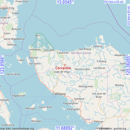
Cervantes GPS coordinates[2]
12° 22' 6.996" North, 124° 39' 34.992" East
| Map corner | latitude | longitude |
|---|---|---|
| Upper-left | 13.0545°, | 123.9566° |
| Center: | 12.36861°, | 124.65972° |
| Lower-right: | 11.68092°, | 125.36285° |
| Map W x H: | 152.7×152.7 km | = 94.9×94.9mi |
| max Lat: | 20.78733° ⇑46.1% North |
| Cervantes: | 12.36861° |
| min Lat: | ⇓53.9% South 4.65442° |
| min Long | Cervantes | max Long |
| 117.04868° | 124.65972° | 126.58417° |
| W 81.9%⇐ | ⇒18.1% E |
Elevation
Elevation of Cervantes is 22 m = 72 ft, and this is 65.9 m = 216 ft below average elevation for this country.
| Max E: |
2262 m = 7421 ft | 51.8% |
| Avg. | 87.9 m = 288 ft | |
| Cervantes | 22 m = 72 ft | |
Min E: |
-2 m = -7 ft | 48.2% |
See also: Philippines elevation on elevation.city.
Geographical zone
Cervantes is located in North Torrid zone (between Equator and Tropic of Cancer). Distance of this Northern Tropic circle is 1230.7 km =764.7 mi to North.| Distance of | km | miles | from Cervantes |
|---|---|---|---|
| North Pole | 8631.8 | 5363.6 | to North |
| Arctic Circle | 6025.9 | 3744.3 | to North |
| Tropic Cancer | 1230.7 | 764.7 | to North |
| Equator | 1375.3 | 854.6 | to South |


Nearby cities:
15 places around Cervantes: (largest is in red/bold)
• Bantayan
25.1 km =15.6 mi,  46°
46°
• Bobon
20.2 km =12.6 mi,  328°
328°
• Bugko
23.5 km =14.6 mi,  37°
37°
• Catarman
14.7 km =9.1 mi,  350°
350°
• Lope de Vega
8.7 km =5.4 mi,  206°
206°
• Makiwalo
16.5 km =10.3 mi,  17°
17°
• Malaga
34.2 km =21.3 mi,  244°
244°
• Mondragon
19.2 km =11.9 mi,  31°
31°
• Nenita
20.8 km =12.9 mi, 48°
• Polañge
4.4 km =2.7 mi,  315°
315°
• Rosario
30.7 km =19.1 mi,  303°
303°
• San Joaquin
33.5 km =20.8 mi,  228°
228°
• San Jose
25.9 km =16.1 mi,  313°
313°
• San Roque
29 km =18 mi, 50°
• Silvino Lobos
20.3 km =12.6 mi,  112°
112°
Sources, notices
• [Note1] Compared only with cities in Philippines existing in our database
• [Src1] Map data: © OpenStreetMap contributors (CC-BY-SA)
• [Src2] Other city data from geonames.org with taken over terms of usage.
• [Src3] Geographical zone / Annual Mean Temperature by Robert A. Rohde @ Wikipedia
