Pigcawayan geodata
Pigcawayan (Soccsksargen) is a populated place; located in Philippines in Asia/Manila (GMT+8) time zone. With population of 11,420 people, there are 540 cities with bigger population in this country. Compared to other cities in Philippines, 88.8% of cities are located further ↑North; 77.8% of cities are located further ←West and 56.1% of cities have higher elevation than Pigcawayan. Note1


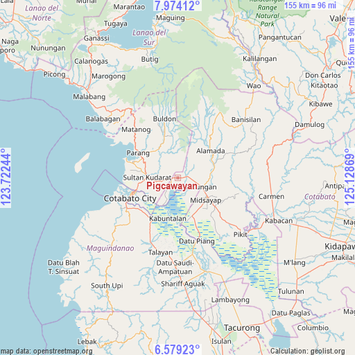
Pigcawayan GPS coordinates[2]
7° 16' 37.992" North, 124° 25' 32.016" East
| Map corner | latitude | longitude |
|---|---|---|
| Upper-left | 7.97412°, | 123.72244° |
| Center: | 7.27722°, | 124.42556° |
| Lower-right: | 6.57923°, | 125.12869° |
| Map W x H: | 155.1×155.1 km | = 96.4×96.4mi |
| max Lat: | 20.78733° ⇑88.8% North |
| Pigcawayan: | 7.27722° |
| min Lat: | ⇓11.2% South 4.65442° |
| min Long | Pigcawayan | max Long |
| 117.04868° | 124.42556° | 126.58417° |
| W 77.8%⇐ | ⇒22.2% E |
Elevation
Elevation of Pigcawayan is 19 m = 62 ft, and this is 68.9 m = 226 ft below average elevation for this country.
| Max E: |
2262 m = 7421 ft | 56.1% |
| Avg. | 87.9 m = 288 ft | |
| Pigcawayan | 19 m = 62 ft | |
Min E: |
-2 m = -7 ft | 43.9% |
See also: Philippines elevation on elevation.city.
Geographical zone
Pigcawayan is located in North Torrid zone (between Equator and Tropic of Cancer). Distance of Equator is 809.2 km =502.8 mi to South.| Distance of | km | miles | from Pigcawayan |
|---|---|---|---|
| North Pole | 9197.9 | 5715.3 | to North |
| Arctic Circle | 6592 | 4096.1 | to North |
| Tropic Cancer | 1796.8 | 1116.5 | to North |
| Equator | 809.2 | 502.8 | to South |


Nearby cities:
15 places around Pigcawayan: (largest is in red/bold)
• Baguer
9 km =5.6 mi,  105°
105°
• Balogo
4.3 km =2.7 mi,  82°
82°
• Barongis
15.4 km =9.6 mi,  96°
96°
• Bual
13.8 km =8.6 mi,  139°
139°
• Buayan
11.6 km =7.2 mi, 98°
• Budta
8.3 km =5.2 mi,  169°
169°
• Dalumangcob
15.4 km =9.6 mi,  244°
244°
• Dinganen
7.7 km =4.8 mi,  317°
317°
• Libungan
11.2 km =7 mi, 111°
• Malingao
14 km =8.7 mi,  157°
157°
• Manuangan
2.3 km =1.4 mi,  269°
269°
• Midsayap
15 km =9.3 mi,  129°
129°
• Patindeguen
10.3 km =6.4 mi, 128°
• Pinaring
13.8 km =8.6 mi,  247°
247°
• Simuay
13.1 km =8.1 mi, 270°
Sources, notices
• [Note1] Compared only with cities in Philippines existing in our database
• [Src1] Map data: © OpenStreetMap contributors (CC-BY-SA)
• [Src2] Other city data from geonames.org with taken over terms of usage.
• [Src3] Geographical zone / Annual Mean Temperature by Robert A. Rohde @ Wikipedia
