Simuay geodata
Simuay (Autonomous Region in Muslim Mindanao) is a populated place; located in Philippines in Asia/Manila (GMT+8) time zone. With population of 4,666 people, there are 1428 cities with bigger population in this country. Compared to other cities in Philippines, 88.8% of cities are located further ↑North; 75.7% of cities are located further ←West and 69.6% of cities have lower elevation than Simuay. Note1
Administrative division(s):
- Level 1: Autonomous Region in Muslim Mindanao
- Level 2: Province of Maguindanao
- Level 3: Sultan Kudarat (Nuling)


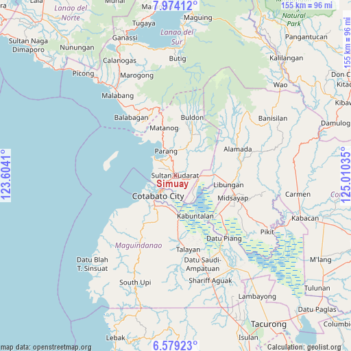
Simuay GPS coordinates[2]
7° 16' 37.992" North, 124° 18' 25.992" East
| Map corner | latitude | longitude |
|---|---|---|
| Upper-left | 7.97412°, | 123.6041° |
| Center: | 7.27722°, | 124.30722° |
| Lower-right: | 6.57923°, | 125.01035° |
| Map W x H: | 155.1×155.1 km | = 96.4×96.4mi |
| max Lat: | 20.78733° ⇑88.8% North |
| Simuay: | 7.27722° |
| min Lat: | ⇓11.2% South 4.65442° |
| min Long | Simuay | max Long |
| 117.04868° | 124.30722° | 126.58417° |
| W 75.7%⇐ | ⇒24.3% E |
Elevation
Elevation of Simuay is 51 m = 167 ft, and this is 36.9 m = 121 ft below average elevation for this country.
| Max E: |
2262 m = 7421 ft | 30.4% |
| Avg. | 87.9 m = 288 ft | |
| Simuay | 51 m = 167 ft | |
Min E: |
-2 m = -7 ft | 69.6% |
See also: Philippines elevation on elevation.city.
Geographical zone
Simuay is located in North Torrid zone (between Equator and Tropic of Cancer). Distance of Equator is 809.2 km =502.8 mi to South.| Distance of | km | miles | from Simuay |
|---|---|---|---|
| North Pole | 9197.9 | 5715.3 | to North |
| Arctic Circle | 6592 | 4096.1 | to North |
| Tropic Cancer | 1796.8 | 1116.5 | to North |
| Equator | 809.2 | 502.8 | to South |


Nearby cities:
15 places around Simuay: (largest is in red/bold)
• Baka
4.7 km =2.9 mi,  268°
268°
• Cotabato
9 km =5.6 mi,  228°
228°
• Dalumangcob
6.8 km =4.2 mi,  186°
186°
• Dinganen
9.7 km =6 mi,  54°
54°
• Gang
5.7 km =3.5 mi, 232°
• Katidtuan
9.9 km =6.2 mi,  174°
174°
• Limbo
7.5 km =4.7 mi,  247°
247°
• Manuangan
10.7 km =6.6 mi,  90°
90°
• Parang
11.1 km =6.9 mi,  338°
338°
• Pigcawayan
13.1 km =8.1 mi, 90°
• Pinaring
5.4 km =3.4 mi,  176°
176°
• Polloc
12.7 km =7.9 mi,  311°
311°
• Salimbao
8.5 km =5.3 mi,  224°
224°
• Sultan Kudarat
7.7 km =4.8 mi, 225°
• Tapayan
4.9 km =3 mi,  292°
292°
Sources, notices
• [Note1] Compared only with cities in Philippines existing in our database
• [Src1] Map data: © OpenStreetMap contributors (CC-BY-SA)
• [Src2] Other city data from geonames.org with taken over terms of usage.
• [Src3] Geographical zone / Annual Mean Temperature by Robert A. Rohde @ Wikipedia
