Pamplona geodata
Pamplona (Bicol) is a seat of a third-order administrative division; located in Philippines in Asia/Manila (GMT+8) time zone. With population of 4,884 people, there are 1345 cities with bigger population in this country. Compared to other cities in Philippines, 63.1% of cities are located further ↓South; 54.7% of cities are located further ←West and 80.7% of cities have higher elevation than Pamplona. Note1


Pamplona GPS coordinates[2]
13° 35' 29.76" North, 123° 4' 53.76" East
| Map corner | latitude | longitude |
|---|---|---|
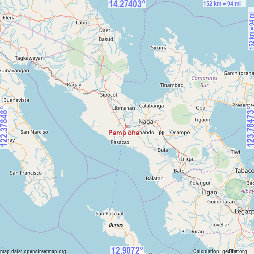
| Upper-left | 14.27403°, | 122.37848° |
| Center: | 13.5916°, | 123.0816° |
| Lower-right: | 12.9072°, | 123.78473° |
| Map W x H: | 152×152 km | = 94.4×94.4mi |
| max Lat: | 20.78733° ⇑36.9% North |
| Pamplona: | 13.5916° |
| min Lat: | ⇓63.1% South 4.65442° |
| min Long | Pamplona | max Long |
| 117.04868° | 123.0816° | 126.58417° |
| W 54.7%⇐ | ⇒45.3% E |
Elevation
Elevation of Pamplona is 9 m = 30 ft, and this is 78.9 m = 259 ft below average elevation for this country.
| Max E: |
2262 m = 7421 ft | 80.7% |
| Avg. | 87.9 m = 288 ft | |
| Pamplona | 9 m = 30 ft | |
Min E: |
-2 m = -7 ft | 19.3% |
See also: Philippines elevation on elevation.city.
Geographical zone
Pamplona is located in North Torrid zone (between Equator and Tropic of Cancer). Distance of this Northern Tropic circle is 1094.7 km =680.2 mi to North.| Distance of | km | miles | from Pamplona |
|---|---|---|---|
| North Pole | 8495.8 | 5279 | to North |
| Arctic Circle | 5889.9 | 3659.8 | to North |
| Tropic Cancer | 1094.7 | 680.2 | to North |
| Equator | 1511.2 | 939 | to South |


Nearby cities:
15 places around Pamplona: (largest is in red/bold)
• Bahay
6.9 km =4.3 mi,  219°
219°
• Beberon
8.3 km =5.2 mi,  129°
129°
• Camaligan
9.8 km =6.1 mi,  69°
69°
• Dugcal
9.3 km =5.8 mi, 67°
• Gainza
7.1 km =4.4 mi, 66°
• Lupi
9.8 km =6.1 mi, 131°
• Marupit
10 km =6.2 mi, 66°
• Odicon
7.3 km =4.5 mi,  199°
199°
• Pasacao
9.8 km =6.1 mi,  205°
205°
• Quitang
5.4 km =3.4 mi, 214°
• San Fernando
7.5 km =4.7 mi,  112°
112°
• San Gabriel
3.4 km =2.1 mi,  144°
144°
• San Ramon
5.5 km =3.4 mi,  302°
302°
• San Vicente
3.6 km =2.2 mi,  236°
236°
• Tambo
7 km =4.3 mi, 224°
Sources, notices
• [Note1] Compared only with cities in Philippines existing in our database
• [Src1] Map data: © OpenStreetMap contributors (CC-BY-SA)
• [Src2] Other city data from geonames.org with taken over terms of usage.
• [Src3] Geographical zone / Annual Mean Temperature by Robert A. Rohde @ Wikipedia
