Bahay geodata
Bahay (Bicol) is a populated place; located in Philippines in Asia/Manila (GMT+8) time zone. With population of 2,501 people, there are 3283 cities with bigger population in this country. Compared to other cities in Philippines, 62.6% of cities are located further ↓South; 54% of cities are located further ←West and 59.2% of cities have higher elevation than Bahay. Note1


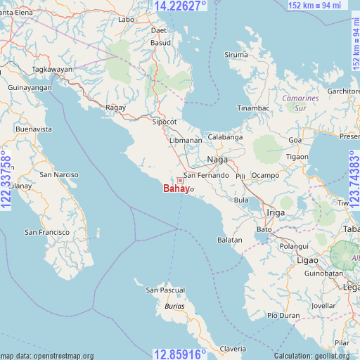
Bahay GPS coordinates[2]
13° 32' 37.32" North, 123° 2' 26.52" East
| Map corner | latitude | longitude |
|---|---|---|
| Upper-left | 14.22627°, | 122.33758° |
| Center: | 13.5437°, | 123.0407° |
| Lower-right: | 12.85916°, | 123.74383° |
| Map W x H: | 152×152 km | = 94.4×94.4mi |
| max Lat: | 20.78733° ⇑37.4% North |
| Bahay: | 13.5437° |
| min Lat: | ⇓62.6% South 4.65442° |
| min Long | Bahay | max Long |
| 117.04868° | 123.0407° | 126.58417° |
| W 54%⇐ | ⇒46% E |
Elevation
Elevation of Bahay is 17 m = 56 ft, and this is 70.9 m = 233 ft below average elevation for this country.
| Max E: |
2262 m = 7421 ft | 59.2% |
| Avg. | 87.9 m = 288 ft | |
| Bahay | 17 m = 56 ft | |
Min E: |
-2 m = -7 ft | 40.8% |
See also: Philippines elevation on elevation.city.
Geographical zone
Bahay is located in North Torrid zone (between Equator and Tropic of Cancer). Distance of this Northern Tropic circle is 1100 km =683.5 mi to North.| Distance of | km | miles | from Bahay |
|---|---|---|---|
| North Pole | 8501.1 | 5282.3 | to North |
| Arctic Circle | 5895.3 | 3663.2 | to North |
| Tropic Cancer | 1100 | 683.5 | to North |
| Equator | 1505.9 | 935.7 | to South |


Nearby cities:
15 places around Bahay: (largest is in red/bold)
• Antipolo
13.2 km =8.2 mi,  97°
97°
• Balogo
5.3 km =3.3 mi,  151°
151°
• Beberon
10.8 km =6.7 mi,  89°
89°
• Caranan
4 km =2.5 mi,  222°
222°
• Dalupaon
10.3 km =6.4 mi,  274°
274°
• Lupi
11.9 km =7.4 mi, 95°
• Odicon
2.5 km =1.6 mi,  127°
127°
• Pamplona
6.9 km =4.3 mi,  39°
39°
• Pasacao
3.6 km =2.2 mi,  176°
176°
• Quitang
1.6 km =1 mi,  57°
57°
• San Fernando
11.6 km =7.2 mi,  77°
77°
• San Gabriel
6.9 km =4.3 mi,  68°
68°
• San Ramon
8.3 km =5.2 mi,  358°
358°
• San Vicente
3.6 km =2.2 mi,  22°
22°
• Tambo
0.6 km =0.4 mi,  303°
303°
Sources, notices
• [Note1] Compared only with cities in Philippines existing in our database
• [Src1] Map data: © OpenStreetMap contributors (CC-BY-SA)
• [Src2] Other city data from geonames.org with taken over terms of usage.
• [Src3] Geographical zone / Annual Mean Temperature by Robert A. Rohde @ Wikipedia
