Pagsañgahan geodata
Pagsañgahan (Calabarzon) is a populated place; located in Philippines in Asia/Manila (GMT+8) time zone. With population of 13,573 people, there are 483 cities with bigger population in this country. Compared to other cities in Philippines, 58.9% of cities are located further ↓South; 53.8% of cities are located further →East and 54.4% of cities have lower elevation than Pagsañgahan. Note1
Administrative division(s):
- Level 1: Calabarzon
- Level 2: Province of Quezon
- Level 3: San Francisco (Aurora)


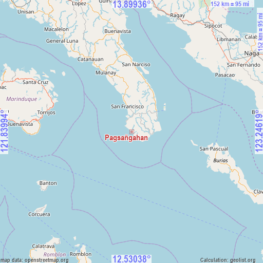
Pagsañgahan GPS coordinates[2]
13° 12' 56.988" North, 122° 32' 35.016" East
| Map corner | latitude | longitude |
|---|---|---|
| Upper-left | 13.89936°, | 121.83994° |
| Center: | 13.21583°, | 122.54306° |
| Lower-right: | 12.53038°, | 123.24619° |
| Map W x H: | 152.2×152.2 km | = 94.6×94.6mi |
| max Lat: | 20.78733° ⇑41.1% North |
| Pagsañgahan: | 13.21583° |
| min Lat: | ⇓58.9% South 4.65442° |
| min Long | Pagsañgahan | max Long |
| 117.04868° | 122.54306° | 126.58417° |
| W 46.2%⇐ | ⇒53.8% E |
Elevation
Elevation of Pagsañgahan is 27 m = 89 ft, and this is 60.9 m = 200 ft below average elevation for this country.
| Max E: |
2262 m = 7421 ft | 45.6% |
| Avg. | 87.9 m = 288 ft | |
| Pagsañgahan | 27 m = 89 ft | |
Min E: |
-2 m = -7 ft | 54.4% |
See also: Philippines elevation on elevation.city.
Geographical zone
Pagsañgahan is located in North Torrid zone (between Equator and Tropic of Cancer). Distance of this Northern Tropic circle is 1136.5 km =706.2 mi to North.| Distance of | km | miles | from Pagsañgahan |
|---|---|---|---|
| North Pole | 8537.6 | 5305 | to North |
| Arctic Circle | 5931.7 | 3685.8 | to North |
| Tropic Cancer | 1136.5 | 706.2 | to North |
| Equator | 1469.5 | 913.1 | to South |


Nearby cities:
15 places around Pagsañgahan: (largest is in red/bold)
• Aurora
14.9 km =9.3 mi,  350°
350°
• Binay
32.4 km =20.1 mi,  10°
10°
• Bosdak
21 km =13 mi, 347°
• Camp Flora
19.9 km =12.4 mi,  41°
41°
• Casay
5.8 km =3.6 mi,  336°
336°
• Cawayan
17.2 km =10.7 mi, 347°
• Ibabang Tayuman
21.1 km =13.1 mi, 352°
• Mangero
15.8 km =9.8 mi,  67°
67°
• Pansoy
7.2 km =4.5 mi,  121°
121°
• Patabog
27 km =16.8 mi, 339°
• San Andres
18.8 km =11.7 mi,  50°
50°
• Silongin
9.6 km =6 mi, 346°
• Tala
8 km =5 mi, 35°
• Talisay
9.6 km =6 mi,  114°
114°
• Yuni
22.8 km =14.2 mi, 343°
Sources, notices
• [Note1] Compared only with cities in Philippines existing in our database
• [Src1] Map data: © OpenStreetMap contributors (CC-BY-SA)
• [Src2] Other city data from geonames.org with taken over terms of usage.
• [Src3] Geographical zone / Annual Mean Temperature by Robert A. Rohde @ Wikipedia
