Bosdak geodata
Bosdak (Calabarzon) is a populated place; located in Philippines in Asia/Manila (GMT+8) time zone. With population of 2,549 people, there are 3211 cities with bigger population in this country. Compared to other cities in Philippines, 61.2% of cities are located further ↓South; 54.8% of cities are located further →East and 65.1% of cities have higher elevation than Bosdak. Note1
Administrative division(s):
- Level 1: Calabarzon
- Level 2: Province of Quezon
- Level 3: San Francisco (Aurora)


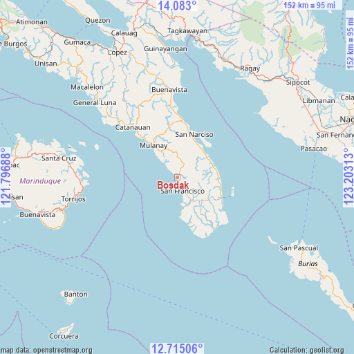
Bosdak GPS coordinates[2]
13° 24' 0" North, 122° 30' 0" East
| Map corner | latitude | longitude |
|---|---|---|
| Upper-left | 14.083°, | 121.79688° |
| Center: | 13.4°, | 122.5° |
| Lower-right: | 12.71506°, | 123.20313° |
| Map W x H: | 152.1×152.1 km | = 94.5×94.5mi |
| max Lat: | 20.78733° ⇑38.8% North |
| Bosdak: | 13.4° |
| min Lat: | ⇓61.2% South 4.65442° |
| min Long | Bosdak | max Long |
| 117.04868° | 122.5° | 126.58417° |
| W 45.2%⇐ | ⇒54.8% E |
Elevation
Elevation of Bosdak is 14 m = 46 ft, and this is 73.9 m = 242 ft below average elevation for this country.
| Max E: |
2262 m = 7421 ft | 65.1% |
| Avg. | 87.9 m = 288 ft | |
| Bosdak | 14 m = 46 ft | |
Min E: |
-2 m = -7 ft | 34.9% |
See also: Philippines elevation on elevation.city.
Geographical zone
Bosdak is located in North Torrid zone (between Equator and Tropic of Cancer). Distance of this Northern Tropic circle is 1116 km =693.5 mi to North.| Distance of | km | miles | from Bosdak |
|---|---|---|---|
| North Pole | 8517.1 | 5292.3 | to North |
| Arctic Circle | 5911.2 | 3673 | to North |
| Tropic Cancer | 1116 | 693.5 | to North |
| Equator | 1489.9 | 925.8 | to South |


Nearby cities:
15 places around Bosdak: (largest is in red/bold)
• Aurora
6.2 km =3.9 mi,  160°
160°
• Binay
15.5 km =9.6 mi,  43°
43°
• Camp Flora
18.6 km =11.6 mi,  107°
107°
• Casay
15.4 km =9.6 mi,  171°
171°
• Cawayan
3.8 km =2.4 mi, 164°
• Ibabang Tayuman
1.8 km =1.1 mi,  75°
75°
• Mulanay
17.1 km =10.6 mi,  322°
322°
• Pagsañgahan
21 km =13 mi, 167°
• Patabog
6.8 km =4.2 mi, 315°
• San Andres
21.1 km =13.1 mi, 114°
• San Juan
16.3 km =10.1 mi,  32°
32°
• San Narciso
20 km =12.4 mi,  21°
21°
• Silongin
11.4 km =7.1 mi, 168°
• Tala
16.8 km =10.4 mi,  146°
146°
• Yuni
2.2 km =1.4 mi,  309°
309°
Sources, notices
• [Note1] Compared only with cities in Philippines existing in our database
• [Src1] Map data: © OpenStreetMap contributors (CC-BY-SA)
• [Src2] Other city data from geonames.org with taken over terms of usage.
• [Src3] Geographical zone / Annual Mean Temperature by Robert A. Rohde @ Wikipedia
