Mantampay geodata
Mantampay (Northern Mindanao) is a populated place; located in Philippines in Asia/Manila (GMT+8) time zone. With population of 265,032 people, there are 36 cities with bigger population in this country. Compared to other cities in Philippines, 81.1% of cities are located further ↑North; 74.1% of cities are located further ←West and 87.3% of cities have lower elevation than Mantampay. Note1
Administrative division(s):
- Level 1: Northern Mindanao
- Level 2: Province of Lanao del Norte
- Level 3: Iligan City


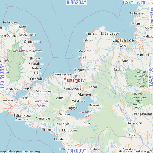
Mantampay GPS coordinates[2]
8° 10' 0.012" North, 124° 13' 0.012" East
| Map corner | latitude | longitude |
|---|---|---|
| Upper-left | 8.86204°, | 123.51355° |
| Center: | 8.16667°, | 124.21667° |
| Lower-right: | 7.47009°, | 124.9198° |
| Map W x H: | 154.8×154.8 km | = 96.2×96.2mi |
| max Lat: | 20.78733° ⇑81.1% North |
| Mantampay: | 8.16667° |
| min Lat: | ⇓18.9% South 4.65442° |
| min Long | Mantampay | max Long |
| 117.04868° | 124.21667° | 126.58417° |
| W 74.1%⇐ | ⇒25.9% E |
Elevation
Elevation of Mantampay is 172 m = 564 ft, and this is 84.1 m = 276 ft above average elevation for this country.
| Max E: |
2262 m = 7421 ft | 12.7% |
| Mantampay | 172 m 564 ft | |
| Avg. | 87.9 m = 288 ft | |
Min E: |
-2 m = -7 ft | 87.3% |
See also: Mantampay elevation on elevation.city.
Geographical zone
Mantampay is located in North Torrid zone (between Equator and Tropic of Cancer). Distance of Equator is 908 km =564.2 mi to South.| Distance of | km | miles | from Mantampay |
|---|---|---|---|
| North Pole | 9099 | 5653.9 | to North |
| Arctic Circle | 6493.1 | 4034.6 | to North |
| Tropic Cancer | 1697.9 | 1055 | to North |
| Equator | 908 | 564.2 | to South |


Nearby cities:
15 places around Mantampay: (largest is in red/bold)
• Boroon
4.7 km =2.9 mi,  292°
292°
• Digkilaan
14.5 km =9 mi,  49°
49°
• Dimayon
13.3 km =8.3 mi,  213°
213°
• Iligan
7.5 km =4.7 mi,  23°
23°
• Kalanganan
9.8 km =6.1 mi,  160°
160°
• Libertad
9.4 km =5.8 mi,  11°
11°
• Linamon
6.3 km =3.9 mi, 289°
• Mamungan
5.5 km =3.4 mi,  177°
177°
• Maria Cristina
1.4 km =0.9 mi,  267°
267°
• Matungao
6.7 km =4.2 mi,  239°
239°
• Nañgka
3.7 km =2.3 mi, 270°
• Pantao-Ragat
13 km =8.1 mi,  224°
224°
• Pantar
12.1 km =7.5 mi, 157°
• Poona-Piagapo
14.4 km =8.9 mi,  229°
229°
• Tacub
12.2 km =7.6 mi,  280°
280°
Sources, notices
• [Note1] Compared only with cities in Philippines existing in our database
• [Src1] Map data: © OpenStreetMap contributors (CC-BY-SA)
• [Src2] Other city data from geonames.org with taken over terms of usage.
• [Src3] Geographical zone / Annual Mean Temperature by Robert A. Rohde @ Wikipedia
