Malapatan geodata
Malapatan (Soccsksargen) is a populated place; located in Philippines in Asia/Manila (GMT+8) time zone. With population of 19,439 people, there are 376 cities with bigger population in this country. Compared to other cities in Philippines, 98.1% of cities are located further ↑North; 91.3% of cities are located further ←West and 53.5% of cities have lower elevation than Malapatan. Note1


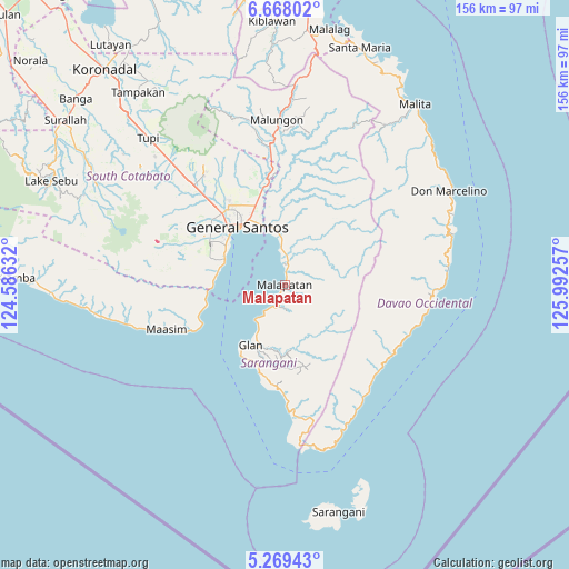
Malapatan GPS coordinates[2]
5° 58' 9.012" North, 125° 17' 21.984" East
| Map corner | latitude | longitude |
|---|---|---|
| Upper-left | 6.66802°, | 124.58632° |
| Center: | 5.96917°, | 125.28944° |
| Lower-right: | 5.26943°, | 125.99257° |
| Map W x H: | 155.5×155.5 km | = 96.6×96.6mi |
| max Lat: | 20.78733° ⇑98.1% North |
| Malapatan: | 5.96917° |
| min Lat: | ⇓1.9% South 4.65442° |
| min Long | Malapatan | max Long |
| 117.04868° | 125.28944° | 126.58417° |
| W 91.3%⇐ | ⇒8.7% E |
Elevation
Elevation of Malapatan is 26 m = 85 ft, and this is 61.9 m = 203 ft below average elevation for this country.
| Max E: |
2262 m = 7421 ft | 46.5% |
| Avg. | 87.9 m = 288 ft | |
| Malapatan | 26 m = 85 ft | |
Min E: |
-2 m = -7 ft | 53.5% |
See also: Philippines elevation on elevation.city.
Geographical zone
Malapatan is located in North Torrid zone (between Equator and Tropic of Cancer). Distance of Equator is 663.7 km =412.4 mi to South.| Distance of | km | miles | from Malapatan |
|---|---|---|---|
| North Pole | 9343.4 | 5805.7 | to North |
| Arctic Circle | 6737.5 | 4186.5 | to North |
| Tropic Cancer | 1942.2 | 1206.8 | to North |
| Equator | 663.7 | 412.4 | to South |


Nearby cities:
15 places around Malapatan: (largest is in red/bold)
• Alabel
14.7 km =9.1 mi,  0°
0°
• Buayan
17.5 km =10.9 mi,  339°
339°
• General Santos
20.6 km =12.8 mi,  320°
320°
• Glan
18.7 km =11.6 mi,  210°
210°
• Glan Peidu
14.9 km =9.3 mi, 211°
• Ilaya
18.5 km =11.5 mi,  202°
202°
• Kablalan
23.4 km =14.5 mi, 205°
• Kapatan
9.5 km =5.9 mi,  216°
216°
• Kiupo
14.6 km =9.1 mi,  166°
166°
• Lun Pequeño
7.7 km =4.8 mi,  355°
355°
• Sapu Padidu
6.3 km =3.9 mi, 203°
• Suyan
14.7 km =9.1 mi,  46°
46°
• Taluya
21.8 km =13.5 mi, 216°
• Tañgo
12.3 km =7.6 mi, 217°
• Tuyan
3.5 km =2.2 mi,  348°
348°
Sources, notices
• [Note1] Compared only with cities in Philippines existing in our database
• [Src1] Map data: © OpenStreetMap contributors (CC-BY-SA)
• [Src2] Other city data from geonames.org with taken over terms of usage.
• [Src3] Geographical zone / Annual Mean Temperature by Robert A. Rohde @ Wikipedia
