Kitcharao geodata
Kitcharao (Caraga) is a seat of a third-order administrative division; located in Philippines in Asia/Manila (GMT+8) time zone. With population of 7,213 people, there are 871 cities with bigger population in this country. Compared to other cities in Philippines, 73.4% of cities are located further ↑North; 94.3% of cities are located further ←West and 70.8% of cities have lower elevation than Kitcharao. Note1
Administrative division(s):
- Level 1: Caraga
- Level 2: Province of Agusan del Norte
- Level 3: Kitcharao


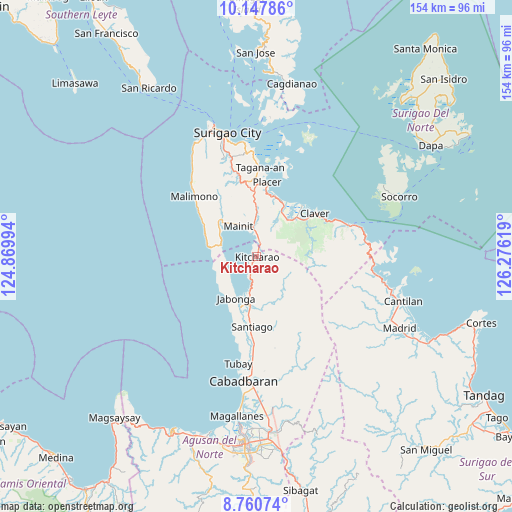
Kitcharao GPS coordinates[2]
9° 27' 18" North, 125° 34' 23.016" East
| Map corner | latitude | longitude |
|---|---|---|
| Upper-left | 10.14786°, | 124.86994° |
| Center: | 9.455°, | 125.57306° |
| Lower-right: | 8.76074°, | 126.27619° |
| Map W x H: | 154.2×154.2 km | = 95.8×95.8mi |
| max Lat: | 20.78733° ⇑73.4% North |
| Kitcharao: | 9.455° |
| min Lat: | ⇓26.6% South 4.65442° |
| min Long | Kitcharao | max Long |
| 117.04868° | 125.57306° | 126.58417° |
| W 94.3%⇐ | ⇒5.7% E |
Elevation
Elevation of Kitcharao is 54 m = 177 ft, and this is 33.9 m = 111 ft below average elevation for this country.
| Max E: |
2262 m = 7421 ft | 29.2% |
| Avg. | 87.9 m = 288 ft | |
| Kitcharao | 54 m = 177 ft | |
Min E: |
-2 m = -7 ft | 70.8% |
See also: Philippines elevation on elevation.city.
Geographical zone
Kitcharao is located in North Torrid zone (between Equator and Tropic of Cancer). Distance of Equator is 1051.3 km =653.2 mi to South.| Distance of | km | miles | from Kitcharao |
|---|---|---|---|
| North Pole | 8955.8 | 5564.9 | to North |
| Arctic Circle | 6349.9 | 3945.6 | to North |
| Tropic Cancer | 1554.6 | 966 | to North |
| Equator | 1051.3 | 653.2 | to South |


Nearby cities:
15 places around Kitcharao: (largest is in red/bold)
• Alegria
1.4 km =0.9 mi,  18°
18°
• Bacuag
18.5 km =11.5 mi, 22°
• Bangonay
15.8 km =9.8 mi,  187°
187°
• Cantapoy
15.5 km =9.6 mi,  284°
284°
• Claver
21.9 km =13.6 mi,  53°
53°
• Gigaquit
20.7 km =12.9 mi,  41°
41°
• Jabonga
14 km =8.7 mi,  206°
206°
• Jagupit
23.7 km =14.7 mi,  183°
183°
• Mainit
10.4 km =6.5 mi,  328°
328°
• Malimono
26.1 km =16.2 mi,  314°
314°
• Placer
22.4 km =13.9 mi,  8°
8°
• San Francisco
12.6 km =7.8 mi, 310°
• Sison
23.3 km =14.5 mi,  347°
347°
• Tagana-an
27 km =16.8 mi,  2°
2°
• Tubod
12 km =7.5 mi,  358°
358°
Sources, notices
• [Note1] Compared only with cities in Philippines existing in our database
• [Src1] Map data: © OpenStreetMap contributors (CC-BY-SA)
• [Src2] Other city data from geonames.org with taken over terms of usage.
• [Src3] Geographical zone / Annual Mean Temperature by Robert A. Rohde @ Wikipedia
