Jabonga geodata
Jabonga (Caraga) is a populated place; located in Philippines in Asia/Manila (GMT+8) time zone. With population of 3,245 people, there are 2262 cities with bigger population in this country. Compared to other cities in Philippines, 73.8% of cities are located further ↑North; 93.6% of cities are located further ←West and 69.6% of cities have lower elevation than Jabonga. Note1


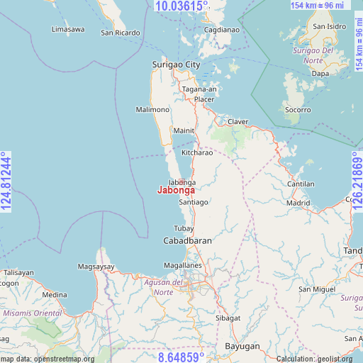
Jabonga GPS coordinates[2]
9° 20' 35.016" North, 125° 30' 56.016" East
| Map corner | latitude | longitude |
|---|---|---|
| Upper-left | 10.03615°, | 124.81244° |
| Center: | 9.34306°, | 125.51556° |
| Lower-right: | 8.64859°, | 126.21869° |
| Map W x H: | 154.3×154.3 km | = 95.9×95.9mi |
| max Lat: | 20.78733° ⇑73.8% North |
| Jabonga: | 9.34306° |
| min Lat: | ⇓26.2% South 4.65442° |
| min Long | Jabonga | max Long |
| 117.04868° | 125.51556° | 126.58417° |
| W 93.6%⇐ | ⇒6.4% E |
Elevation
Elevation of Jabonga is 51 m = 167 ft, and this is 36.9 m = 121 ft below average elevation for this country.
| Max E: |
2262 m = 7421 ft | 30.4% |
| Avg. | 87.9 m = 288 ft | |
| Jabonga | 51 m = 167 ft | |
Min E: |
-2 m = -7 ft | 69.6% |
See also: Philippines elevation on elevation.city.
Geographical zone
Jabonga is located in North Torrid zone (between Equator and Tropic of Cancer). Distance of Equator is 1038.9 km =645.5 mi to South.| Distance of | km | miles | from Jabonga |
|---|---|---|---|
| North Pole | 8968.2 | 5572.6 | to North |
| Arctic Circle | 6362.3 | 3953.3 | to North |
| Tropic Cancer | 1567.1 | 973.8 | to North |
| Equator | 1038.9 | 645.5 | to South |


Nearby cities:
15 places around Jabonga: (largest is in red/bold)
• Alegria
15.3 km =9.5 mi,  26°
26°
• Bangonay
5.3 km =3.3 mi,  127°
127°
• Cabadbaran
24.6 km =15.3 mi,  174°
174°
• Calamba
28 km =17.4 mi,  162°
162°
• Cantapoy
18.6 km =11.6 mi,  332°
332°
• Comagascas
23.1 km =14.4 mi, 167°
• Del Pilar
22.6 km =14 mi, 160°
• Jagupit
12.1 km =7.5 mi, 157°
• Kitcharao
14 km =8.7 mi, 26°
• La Union
28.7 km =17.8 mi,  175°
175°
• Mainit
21.4 km =13.3 mi,  2°
2°
• San Francisco
20.8 km =12.9 mi,  350°
350°
• Santa Ana
17.5 km =10.9 mi, 162°
• Tubay
19.6 km =12.2 mi, 177°
• Tubod
25.1 km =15.6 mi,  13°
13°
Sources, notices
• [Note1] Compared only with cities in Philippines existing in our database
• [Src1] Map data: © OpenStreetMap contributors (CC-BY-SA)
• [Src2] Other city data from geonames.org with taken over terms of usage.
• [Src3] Geographical zone / Annual Mean Temperature by Robert A. Rohde @ Wikipedia
