Magdalena geodata
Magdalena (Calabarzon) is a seat of a third-order administrative division; located in Philippines in Asia/Manila (GMT+8) time zone. With population of 3,167 people, there are 2334 cities with bigger population in this country. Compared to other cities in Philippines, 71.9% of cities are located further ↓South; 68.1% of cities are located further →East and 74.6% of cities have lower elevation than Magdalena. Note1


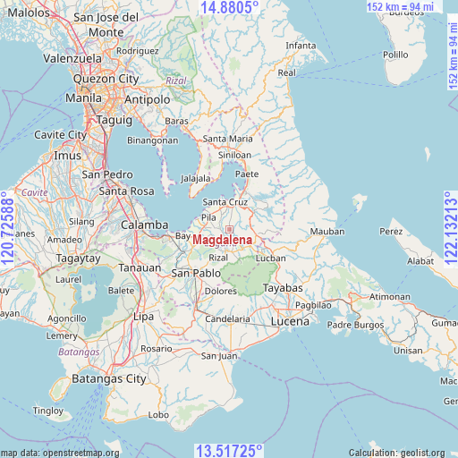
Magdalena GPS coordinates[2]
14° 11' 59.64" North, 121° 25' 44.4" East
| Map corner | latitude | longitude |
|---|---|---|
| Upper-left | 14.8805°, | 120.72588° |
| Center: | 14.1999°, | 121.429° |
| Lower-right: | 13.51725°, | 122.13213° |
| Map W x H: | 151.6×151.6 km | = 94.2×94.2mi |
| max Lat: | 20.78733° ⇑28.1% North |
| Magdalena: | 14.1999° |
| min Lat: | ⇓71.9% South 4.65442° |
| min Long | Magdalena | max Long |
| 117.04868° | 121.429° | 126.58417° |
| W 31.9%⇐ | ⇒68.1% E |
Elevation
Elevation of Magdalena is 67 m = 220 ft, and this is 20.9 m = 69 ft below average elevation for this country.
| Max E: |
2262 m = 7421 ft | 25.4% |
| Avg. | 87.9 m = 288 ft | |
| Magdalena | 67 m = 220 ft | |
Min E: |
-2 m = -7 ft | 74.6% |
See also: Philippines elevation on elevation.city.
Geographical zone
Magdalena is located in North Torrid zone (between Equator and Tropic of Cancer). Distance of this Northern Tropic circle is 1027 km =638.1 mi to North.| Distance of | km | miles | from Magdalena |
|---|---|---|---|
| North Pole | 8428.2 | 5237 | to North |
| Arctic Circle | 5822.3 | 3617.8 | to North |
| Tropic Cancer | 1027 | 638.1 | to North |
| Equator | 1578.9 | 981.1 | to South |


Nearby cities:
15 places around Magdalena: (largest is in red/bold)
• Cabanbanan
4.5 km =2.8 mi,  6°
6°
• Calumpang
2.9 km =1.8 mi,  262°
262°
• Cigaras
3 km =1.9 mi,  1°
1°
• Halayhayin
2.6 km =1.6 mi,  242°
242°
• Lilio
7.7 km =4.8 mi,  174°
174°
• Majayjay
7.6 km =4.7 mi,  141°
141°
• Maulawin
7.4 km =4.6 mi, 3°
• Nagcarlan
7.2 km =4.5 mi,  190°
190°
• Pila
7.8 km =4.8 mi,  297°
297°
• San Antonio
7.7 km =4.8 mi,  89°
89°
• San Diego
6.4 km =4 mi,  102°
102°
• San Isidro
3.4 km =2.1 mi,  286°
286°
• San Miguel
6 km =3.7 mi,  271°
271°
• San Rafael
8.1 km =5 mi, 190°
• Santo Tomas
7.9 km =4.9 mi, 103°
Sources, notices
• [Note1] Compared only with cities in Philippines existing in our database
• [Src1] Map data: © OpenStreetMap contributors (CC-BY-SA)
• [Src2] Other city data from geonames.org with taken over terms of usage.
• [Src3] Geographical zone / Annual Mean Temperature by Robert A. Rohde @ Wikipedia
