San Rafael geodata
San Rafael (Calabarzon) is a populated place; located in Philippines in Asia/Manila (GMT+8) time zone. With population of 3,792 people, there are 1848 cities with bigger population in this country. Compared to other cities in Philippines, 70.9% of cities are located further ↓South; 68.3% of cities are located further →East and 90.5% of cities have lower elevation than San Rafael. Note1


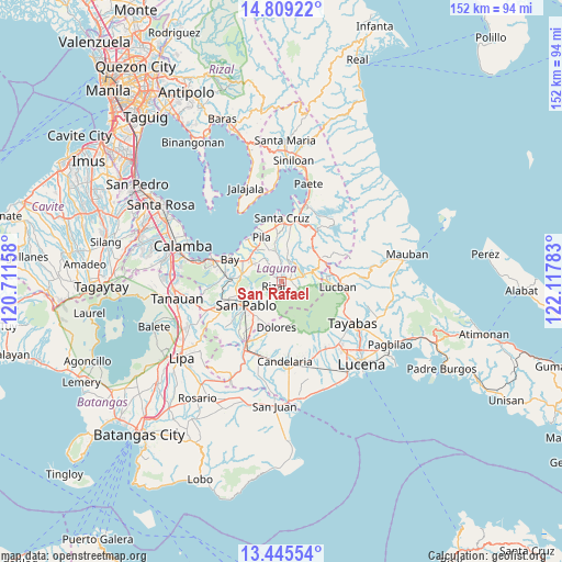
San Rafael GPS coordinates[2]
14° 7' 42.24" North, 121° 24' 52.92" East
| Map corner | latitude | longitude |
|---|---|---|
| Upper-left | 14.80922°, | 120.71158° |
| Center: | 14.1284°, | 121.4147° |
| Lower-right: | 13.44554°, | 122.11783° |
| Map W x H: | 151.6×151.6 km | = 94.2×94.2mi |
| max Lat: | 20.78733° ⇑29.1% North |
| San Rafael: | 14.1284° |
| min Lat: | ⇓70.9% South 4.65442° |
| min Long | San Rafael | max Long |
| 117.04868° | 121.4147° | 126.58417° |
| W 31.7%⇐ | ⇒68.3% E |
Elevation
Elevation of San Rafael is 238 m = 781 ft, and this is 150.1 m = 492 ft above average elevation for this country.
| Max E: |
2262 m = 7421 ft | 9.5% |
| San Rafael | 238 m 781 ft | |
| Avg. | 87.9 m = 288 ft | |
Min E: |
-2 m = -7 ft | 90.5% |
See also: Philippines elevation on elevation.city.
Geographical zone
San Rafael is located in North Torrid zone (between Equator and Tropic of Cancer). Distance of this Northern Tropic circle is 1035 km =643.1 mi to North.| Distance of | km | miles | from San Rafael |
|---|---|---|---|
| North Pole | 8436.1 | 5241.9 | to North |
| Arctic Circle | 5830.2 | 3622.7 | to North |
| Tropic Cancer | 1035 | 643.1 | to North |
| Equator | 1570.9 | 976.1 | to South |


Nearby cities:
15 places around San Rafael: (largest is in red/bold)
• Calumpang
7.7 km =4.8 mi,  349°
349°
• Dayap
10.5 km =6.5 mi,  303°
303°
• Halayhayin
6.8 km =4.2 mi, 353°
• Lilio
2.3 km =1.4 mi,  82°
82°
• Magdalena
8.1 km =5 mi,  10°
10°
• Majayjay
6.6 km =4.1 mi,  72°
72°
• Masapang
10.9 km =6.8 mi,  314°
314°
• Nagcarlan
0.9 km =0.6 mi, 12°
• Rizal
3.1 km =1.9 mi,  227°
227°
• San Diego
10.1 km =6.3 mi,  49°
49°
• San Isidro
9.1 km =5.7 mi, 348°
• San Miguel
9.3 km =5.8 mi,  331°
331°
• Santa Catalina
7.9 km =4.9 mi,  264°
264°
• Santa Lucia
10.5 km =6.5 mi,  170°
170°
• Taytay
1.2 km =0.7 mi, 255°
Sources, notices
• [Note1] Compared only with cities in Philippines existing in our database
• [Src1] Map data: © OpenStreetMap contributors (CC-BY-SA)
• [Src2] Other city data from geonames.org with taken over terms of usage.
• [Src3] Geographical zone / Annual Mean Temperature by Robert A. Rohde @ Wikipedia
