Limon geodata
Limon (Mimaropa) is a populated place; located in Philippines in Asia/Manila (GMT+8) time zone. With population of 2,495 people, there are 3301 cities with bigger population in this country. Compared to other cities in Philippines, 53.3% of cities are located further ↓South; 60% of cities are located further →East and 68% of cities have lower elevation than Limon. Note1


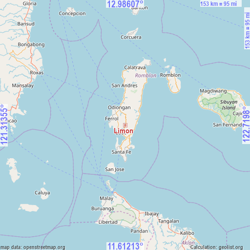
Limon GPS coordinates[2]
12° 18' 0" North, 122° 1' 0.012" East
| Map corner | latitude | longitude |
|---|---|---|
| Upper-left | 12.98607°, | 121.31355° |
| Center: | 12.3°, | 122.01667° |
| Lower-right: | 11.61213°, | 122.7198° |
| Map W x H: | 152.8×152.8 km | = 94.9×94.9mi |
| max Lat: | 20.78733° ⇑46.7% North |
| Limon: | 12.3° |
| min Lat: | ⇓53.3% South 4.65442° |
| min Long | Limon | max Long |
| 117.04868° | 122.01667° | 126.58417° |
| W 40%⇐ | ⇒60% E |
Elevation
Elevation of Limon is 48 m = 157 ft, and this is 39.9 m = 131 ft below average elevation for this country.
| Max E: |
2262 m = 7421 ft | 32% |
| Avg. | 87.9 m = 288 ft | |
| Limon | 48 m = 157 ft | |
Min E: |
-2 m = -7 ft | 68% |
See also: Philippines elevation on elevation.city.
Geographical zone
Limon is located in North Torrid zone (between Equator and Tropic of Cancer). Distance of this Northern Tropic circle is 1238.3 km =769.4 mi to North.| Distance of | km | miles | from Limon |
|---|---|---|---|
| North Pole | 8639.4 | 5368.3 | to North |
| Arctic Circle | 6033.5 | 3749 | to North |
| Tropic Cancer | 1238.3 | 769.4 | to North |
| Equator | 1367.6 | 849.8 | to South |


Nearby cities:
15 places around Limon: (largest is in red/bold)
• Agcogon
27.3 km =17 mi,  193°
193°
• Alcantara
6.1 km =3.8 mi,  138°
138°
• Concepcion
13.7 km =8.5 mi,  37°
37°
• Dapawan
12 km =7.5 mi,  5°
5°
• Ferrol
9.2 km =5.7 mi,  297°
297°
• Gabawan
14.1 km =8.8 mi,  358°
358°
• Libertad
17.2 km =10.7 mi, 356°
• Looc
5.1 km =3.2 mi,  210°
210°
• Odiongan
11.6 km =7.2 mi,  346°
346°
• Panique
20 km =12.4 mi, 359°
• Pato-o
15.5 km =9.6 mi,  20°
20°
• Punta
6.3 km =3.9 mi, 186°
• Santa Fe
16.1 km =10 mi, 188°
• Tomingad
15.9 km =9.9 mi,  1°
1°
• Tugdan
7.6 km =4.7 mi,  78°
78°
Sources, notices
• [Note1] Compared only with cities in Philippines existing in our database
• [Src1] Map data: © OpenStreetMap contributors (CC-BY-SA)
• [Src2] Other city data from geonames.org with taken over terms of usage.
• [Src3] Geographical zone / Annual Mean Temperature by Robert A. Rohde @ Wikipedia
