Tugdan geodata
Tugdan (Mimaropa) is a populated place; located in Philippines in Asia/Manila (GMT+8) time zone. With population of 2,373 people, there are 3511 cities with bigger population in this country. Compared to other cities in Philippines, 53.5% of cities are located further ↓South; 59.1% of cities are located further →East and 80.7% of cities have higher elevation than Tugdan. Note1


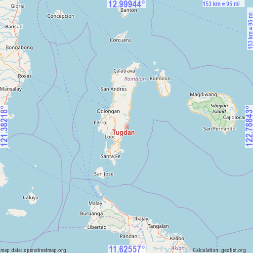
Tugdan GPS coordinates[2]
12° 18' 48.24" North, 122° 5' 7.08" East
| Map corner | latitude | longitude |
|---|---|---|
| Upper-left | 12.99944°, | 121.38218° |
| Center: | 12.3134°, | 122.0853° |
| Lower-right: | 11.62557°, | 122.78843° |
| Map W x H: | 152.8×152.8 km | = 94.9×94.9mi |
| max Lat: | 20.78733° ⇑46.5% North |
| Tugdan: | 12.3134° |
| min Lat: | ⇓53.5% South 4.65442° |
| min Long | Tugdan | max Long |
| 117.04868° | 122.0853° | 126.58417° |
| W 40.9%⇐ | ⇒59.1% E |
Elevation
Elevation of Tugdan is 9 m = 30 ft, and this is 78.9 m = 259 ft below average elevation for this country.
| Max E: |
2262 m = 7421 ft | 80.7% |
| Avg. | 87.9 m = 288 ft | |
| Tugdan | 9 m = 30 ft | |
Min E: |
-2 m = -7 ft | 19.3% |
See also: Philippines elevation on elevation.city.
Geographical zone
Tugdan is located in North Torrid zone (between Equator and Tropic of Cancer). Distance of this Northern Tropic circle is 1236.8 km =768.5 mi to North.| Distance of | km | miles | from Tugdan |
|---|---|---|---|
| North Pole | 8637.9 | 5367.3 | to North |
| Arctic Circle | 6032.1 | 3748.2 | to North |
| Tropic Cancer | 1236.8 | 768.5 | to North |
| Equator | 1369.1 | 850.7 | to South |


Nearby cities:
15 places around Tugdan: (largest is in red/bold)
• Alcantara
6.9 km =4.3 mi,  208°
208°
• Concepcion
9.4 km =5.8 mi,  5°
5°
• Dapawan
12.1 km =7.5 mi,  329°
329°
• Ferrol
15.9 km =9.9 mi,  280°
280°
• Gabawan
14.9 km =9.3 mi, 328°
• Libertad
17.7 km =11 mi, 331°
• Limon
7.6 km =4.7 mi,  258°
258°
• Looc
11.7 km =7.3 mi,  239°
239°
• Odiongan
14.1 km =8.8 mi,  314°
314°
• Panique
20.1 km =12.5 mi,  337°
337°
• Pato-o
13.2 km =8.2 mi,  351°
351°
• Punta
11.3 km =7 mi,  226°
226°
• San Agustin
28.8 km =17.9 mi, 9°
• Santa Fe
20.1 km =12.5 mi, 209°
• Tomingad
16 km =9.9 mi, 334°
Sources, notices
• [Note1] Compared only with cities in Philippines existing in our database
• [Src1] Map data: © OpenStreetMap contributors (CC-BY-SA)
• [Src2] Other city data from geonames.org with taken over terms of usage.
• [Src3] Geographical zone / Annual Mean Temperature by Robert A. Rohde @ Wikipedia
