Limaong geodata
Limaong (Zamboanga Peninsula) is a populated place; located in Philippines in Asia/Manila (GMT+8) time zone. With population of 3,321 people, there are 2203 cities with bigger population in this country. Compared to other cities in Philippines, 88.1% of cities are located further ↑North; 56.7% of cities are located further →East and 59.5% of cities have lower elevation than Limaong. Note1
Administrative division(s):
- Level 1: Zamboanga Peninsula
- Level 2: Province of Zamboanga del Sur
- Level 3: Zamboanga City


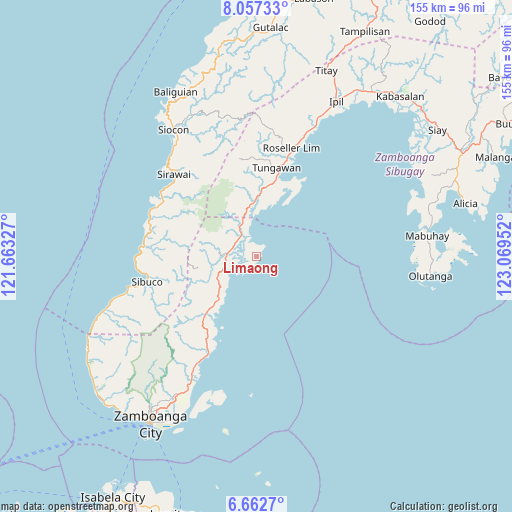
Limaong GPS coordinates[2]
7° 21' 38.016" North, 122° 21' 59.004" East
| Map corner | latitude | longitude |
|---|---|---|
| Upper-left | 8.05733°, | 121.66327° |
| Center: | 7.36056°, | 122.36639° |
| Lower-right: | 6.6627°, | 123.06952° |
| Map W x H: | 155.1×155.1 km | = 96.4×96.4mi |
| max Lat: | 20.78733° ⇑88.1% North |
| Limaong: | 7.36056° |
| min Lat: | ⇓11.9% South 4.65442° |
| min Long | Limaong | max Long |
| 117.04868° | 122.36639° | 126.58417° |
| W 43.3%⇐ | ⇒56.7% E |
Elevation
Elevation of Limaong is 33 m = 108 ft, and this is 54.9 m = 180 ft below average elevation for this country.
| Max E: |
2262 m = 7421 ft | 40.5% |
| Avg. | 87.9 m = 288 ft | |
| Limaong | 33 m = 108 ft | |
Min E: |
-2 m = -7 ft | 59.5% |
See also: Philippines elevation on elevation.city.
Geographical zone
Limaong is located in North Torrid zone (between Equator and Tropic of Cancer). Distance of Equator is 818.4 km =508.5 mi to South.| Distance of | km | miles | from Limaong |
|---|---|---|---|
| North Pole | 9188.6 | 5709.5 | to North |
| Arctic Circle | 6582.8 | 4090.4 | to North |
| Tropic Cancer | 1787.5 | 1110.7 | to North |
| Equator | 818.4 | 508.5 | to South |


Nearby cities:
15 places around Limaong: (largest is in red/bold)
• Bolong
32.4 km =20.1 mi,  205°
205°
• Buenavista
18.5 km =11.5 mi,  221°
221°
• Bunguiao
34.1 km =21.2 mi, 213°
• Calabasa
19.3 km =12 mi,  228°
228°
• Curuan
22.7 km =14.1 mi, 220°
• Dulian
33.7 km =20.9 mi, 217°
• Mangusu
10.5 km =6.5 mi,  248°
248°
• Muti
13.4 km =8.3 mi, 225°
• Quinipot
25.7 km =16 mi, 218°
• Sibulao
14.6 km =9.1 mi, 253°
• Tagasilay
13.5 km =8.4 mi,  241°
241°
• Tigbao
8.7 km =5.4 mi,  330°
330°
• Tigpalay
15.1 km =9.4 mi,  351°
351°
• Tungawan
16.4 km =10.2 mi,  1°
1°
• Vitali
8.7 km =5.4 mi,  277°
277°
Sources, notices
• [Note1] Compared only with cities in Philippines existing in our database
• [Src1] Map data: © OpenStreetMap contributors (CC-BY-SA)
• [Src2] Other city data from geonames.org with taken over terms of usage.
• [Src3] Geographical zone / Annual Mean Temperature by Robert A. Rohde @ Wikipedia
