Tigpalay geodata
Tigpalay (Zamboanga Peninsula) is a populated place; located in Philippines in Asia/Manila (GMT+8) time zone. With population of 5,480 people, there are 1160 cities with bigger population in this country. Compared to other cities in Philippines, 87% of cities are located further ↑North; 56.9% of cities are located further →East and 76.6% of cities have higher elevation than Tigpalay. Note1
Administrative division(s):
- Level 1: Zamboanga Peninsula
- Level 2: Province of Zamboanga Sibugay
- Level 3: Tungawan


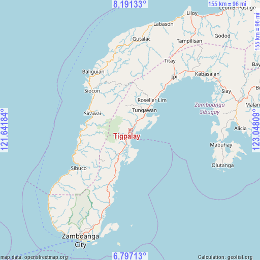
Tigpalay GPS coordinates[2]
7° 29' 41.244" North, 122° 20' 41.856" East
| Map corner | latitude | longitude |
|---|---|---|
| Upper-left | 8.19133°, | 121.64184° |
| Center: | 7.49479°, | 122.34496° |
| Lower-right: | 6.79713°, | 123.04809° |
| Map W x H: | 155×155 km | = 96.3×96.3mi |
| max Lat: | 20.78733° ⇑87% North |
| Tigpalay: | 7.49479° |
| min Lat: | ⇓13% South 4.65442° |
| min Long | Tigpalay | max Long |
| 117.04868° | 122.34496° | 126.58417° |
| W 43.1%⇐ | ⇒56.9% E |
Elevation
Elevation of Tigpalay is 10 m = 33 ft, and this is 77.9 m = 256 ft below average elevation for this country.
| Max E: |
2262 m = 7421 ft | 76.6% |
| Avg. | 87.9 m = 288 ft | |
| Tigpalay | 10 m = 33 ft | |
Min E: |
-2 m = -7 ft | 23.4% |
See also: Philippines elevation on elevation.city.
Geographical zone
Tigpalay is located in North Torrid zone (between Equator and Tropic of Cancer). Distance of Equator is 833.3 km =517.8 mi to South.| Distance of | km | miles | from Tigpalay |
|---|---|---|---|
| North Pole | 9173.7 | 5700.3 | to North |
| Arctic Circle | 6567.8 | 4081 | to North |
| Tropic Cancer | 1772.6 | 1101.4 | to North |
| Equator | 833.3 | 517.8 | to South |


Nearby cities:
15 places around Tigpalay: (largest is in red/bold)
• Buenavista
30.4 km =18.9 mi,  198°
198°
• Calabasa
30.2 km =18.8 mi, 203°
• Curuan
34.5 km =21.4 mi, 200°
• Limaong
15.1 km =9.4 mi,  171°
171°
• Mangusu
20.2 km =12.6 mi, 201°
• Muti
25.4 km =15.8 mi, 196°
• Quinipot
37.6 km =23.4 mi, 201°
• Roseller Lim
22.4 km =13.9 mi,  36°
36°
• Sibulao
22.3 km =13.9 mi,  211°
211°
• Siocon
33 km =20.5 mi,  315°
315°
• Siraway
24.8 km =15.4 mi,  293°
293°
• Tagasilay
23.4 km =14.5 mi, 204°
• Tigbao
7.6 km =4.7 mi,  194°
194°
• Tungawan
3.2 km =2 mi,  62°
62°
• Vitali
15.1 km =9.4 mi, 204°
Sources, notices
• [Note1] Compared only with cities in Philippines existing in our database
• [Src1] Map data: © OpenStreetMap contributors (CC-BY-SA)
• [Src2] Other city data from geonames.org with taken over terms of usage.
• [Src3] Geographical zone / Annual Mean Temperature by Robert A. Rohde @ Wikipedia
