Tungawan geodata
Tungawan (Zamboanga Peninsula) is a seat of a third-order administrative division; located in Philippines in Asia/Manila (GMT+8) time zone. With population of 3,603 people, there are 1978 cities with bigger population in this country. Compared to other cities in Philippines, 86.9% of cities are located further ↑North; 56.6% of cities are located further →East and 65.1% of cities have higher elevation than Tungawan. Note1
Administrative division(s):
- Level 1: Zamboanga Peninsula
- Level 2: Province of Zamboanga Sibugay
- Level 3: Tungawan


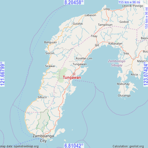
Tungawan GPS coordinates[2]
7° 30' 29.016" North, 122° 22' 15.996" East
| Map corner | latitude | longitude |
|---|---|---|
| Upper-left | 8.20458°, | 121.66799° |
| Center: | 7.50806°, | 122.37111° |
| Lower-right: | 6.81042°, | 123.07424° |
| Map W x H: | 155×155 km | = 96.3×96.3mi |
| max Lat: | 20.78733° ⇑86.9% North |
| Tungawan: | 7.50806° |
| min Lat: | ⇓13.1% South 4.65442° |
| min Long | Tungawan | max Long |
| 117.04868° | 122.37111° | 126.58417° |
| W 43.4%⇐ | ⇒56.6% E |
Elevation
Elevation of Tungawan is 14 m = 46 ft, and this is 73.9 m = 242 ft below average elevation for this country.
| Max E: |
2262 m = 7421 ft | 65.1% |
| Avg. | 87.9 m = 288 ft | |
| Tungawan | 14 m = 46 ft | |
Min E: |
-2 m = -7 ft | 34.9% |
See also: Philippines elevation on elevation.city.
Geographical zone
Tungawan is located in North Torrid zone (between Equator and Tropic of Cancer). Distance of Equator is 834.8 km =518.7 mi to South.| Distance of | km | miles | from Tungawan |
|---|---|---|---|
| North Pole | 9172.2 | 5699.3 | to North |
| Arctic Circle | 6566.4 | 4080.2 | to North |
| Tropic Cancer | 1771.1 | 1100.5 | to North |
| Equator | 834.8 | 518.7 | to South |


Nearby cities:
15 places around Tungawan: (largest is in red/bold)
• Buenavista
32.8 km =20.4 mi,  202°
202°
• Calabasa
32.8 km =20.4 mi,  207°
207°
• Curuan
36.9 km =22.9 mi, 204°
• Limaong
16.4 km =10.2 mi,  181°
181°
• Mangusu
22.8 km =14.2 mi, 206°
• Muti
27.7 km =17.2 mi, 201°
• Roseller Lim
19.6 km =12.2 mi,  32°
32°
• Sibulao
25.1 km =15.6 mi,  215°
215°
• Siocon
34.1 km =21.2 mi,  310°
310°
• Siraway
26.9 km =16.7 mi,  288°
288°
• Tagasilay
26 km =16.2 mi, 208°
• Tigbao
10.1 km =6.3 mi, 208°
• Tigpalay
3.2 km =2 mi,  242°
242°
• Titay
38.3 km =23.8 mi, 27°
• Vitali
17.7 km =11 mi, 210°
Sources, notices
• [Note1] Compared only with cities in Philippines existing in our database
• [Src1] Map data: © OpenStreetMap contributors (CC-BY-SA)
• [Src2] Other city data from geonames.org with taken over terms of usage.
• [Src3] Geographical zone / Annual Mean Temperature by Robert A. Rohde @ Wikipedia
