La Fortuna geodata
La Fortuna (Northern Mindanao) is a populated place; located in Philippines in Asia/Manila (GMT+8) time zone. With population of 2,496 people, there are 3298 cities with bigger population in this country. Compared to other cities in Philippines, 80.1% of cities are located further ↑North; 87.6% of cities are located further ←West and 97.7% of cities have lower elevation than La Fortuna. Note1
Administrative division(s):
- Level 1: Northern Mindanao
- Level 2: Province of Bukidnon
- Level 3: Impasug-Ong


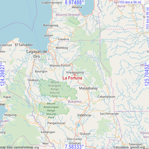
La Fortuna GPS coordinates[2]
8° 16' 46.992" North, 125° 0' 5.004" East
| Map corner | latitude | longitude |
|---|---|---|
| Upper-left | 8.97488°, | 124.29827° |
| Center: | 8.27972°, | 125.00139° |
| Lower-right: | 7.58333°, | 125.70452° |
| Map W x H: | 154.7×154.7 km | = 96.1×96.1mi |
| max Lat: | 20.78733° ⇑80.1% North |
| La Fortuna: | 8.27972° |
| min Lat: | ⇓19.9% South 4.65442° |
| min Long | La Fortuna | max Long |
| 117.04868° | 125.00139° | 126.58417° |
| W 87.6%⇐ | ⇒12.4% E |
Elevation
Elevation of La Fortuna is 711 m = 2333 ft, and this is 623.1 m = 2044 ft above average elevation for this country.
| Max E: |
2262 m = 7421 ft | 2.3% |
| La Fortuna | 711 m 2333 ft | |
| Avg. | 87.9 m = 288 ft | |
Min E: |
-2 m = -7 ft | 97.7% |
See also: Philippines elevation on elevation.city.
Geographical zone
La Fortuna is located in North Torrid zone (between Equator and Tropic of Cancer). Distance of Equator is 920.6 km =572 mi to South.| Distance of | km | miles | from La Fortuna |
|---|---|---|---|
| North Pole | 9086.4 | 5646 | to North |
| Arctic Circle | 6480.6 | 4026.9 | to North |
| Tropic Cancer | 1685.3 | 1047.2 | to North |
| Equator | 920.6 | 572 | to South |


Nearby cities:
15 places around La Fortuna: (largest is in red/bold)
• Canayan
18.3 km =11.4 mi,  120°
120°
• Casisang
20.8 km =12.9 mi,  139°
139°
• Dalirig
15.4 km =9.6 mi,  314°
314°
• Dalwangan
9.8 km =6.1 mi,  153°
153°
• Dumalaguing
9.5 km =5.9 mi,  38°
38°
• Impalutao
3.8 km =2.4 mi,  130°
130°
• Kalugmanan
15.6 km =9.7 mi,  269°
269°
• Kisolon
6.2 km =3.9 mi,  334°
334°
• Malaybalay
19.4 km =12.1 mi, 134°
• Maluko
11.8 km =7.3 mi, 333°
• Manolo Fortich
18.1 km =11.2 mi,  303°
303°
• Pontian
11.1 km =6.9 mi, 270°
• Sankanan
16.3 km =10.1 mi,  284°
284°
• Sumilao
6.2 km =3.9 mi, 277°
• Sumpong
18.3 km =11.4 mi, 135°
Sources, notices
• [Note1] Compared only with cities in Philippines existing in our database
• [Src1] Map data: © OpenStreetMap contributors (CC-BY-SA)
• [Src2] Other city data from geonames.org with taken over terms of usage.
• [Src3] Geographical zone / Annual Mean Temperature by Robert A. Rohde @ Wikipedia
