Maluko geodata
Maluko (Northern Mindanao) is a populated place; located in Philippines in Asia/Manila (GMT+8) time zone. With population of 3,278 people, there are 2234 cities with bigger population in this country. Compared to other cities in Philippines, 79.4% of cities are located further ↑North; 86.9% of cities are located further ←West and 95.1% of cities have lower elevation than Maluko. Note1
Administrative division(s):
- Level 1: Northern Mindanao
- Level 2: Province of Bukidnon
- Level 3: Manolo Fortich


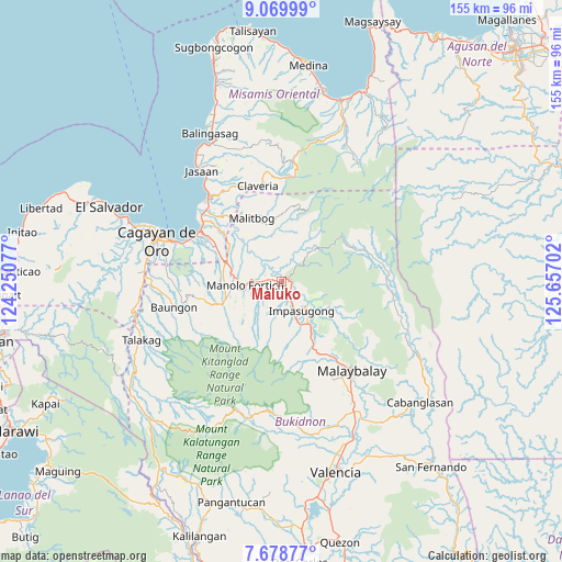
Maluko GPS coordinates[2]
8° 22' 30" North, 124° 57' 14.004" East
| Map corner | latitude | longitude |
|---|---|---|
| Upper-left | 9.06999°, | 124.25077° |
| Center: | 8.375°, | 124.95389° |
| Lower-right: | 7.67877°, | 125.65702° |
| Map W x H: | 154.7×154.7 km | = 96.1×96.1mi |
| max Lat: | 20.78733° ⇑79.4% North |
| Maluko: | 8.375° |
| min Lat: | ⇓20.6% South 4.65442° |
| min Long | Maluko | max Long |
| 117.04868° | 124.95389° | 126.58417° |
| W 86.9%⇐ | ⇒13.1% E |
Elevation
Elevation of Maluko is 417 m = 1368 ft, and this is 329.1 m = 1080 ft above average elevation for this country.
| Max E: |
2262 m = 7421 ft | 4.9% |
| Maluko | 417 m 1368 ft | |
| Avg. | 87.9 m = 288 ft | |
Min E: |
-2 m = -7 ft | 95.1% |
See also: Philippines elevation on elevation.city.
Geographical zone
Maluko is located in North Torrid zone (between Equator and Tropic of Cancer). Distance of Equator is 931.2 km =578.6 mi to South.| Distance of | km | miles | from Maluko |
|---|---|---|---|
| North Pole | 9075.8 | 5639.4 | to North |
| Arctic Circle | 6470 | 4020.3 | to North |
| Tropic Cancer | 1674.7 | 1040.6 | to North |
| Equator | 931.2 | 578.6 | to South |


Nearby cities:
15 places around Maluko: (largest is in red/bold)
• Alae
16.5 km =10.3 mi,  289°
289°
• Dalirig
5.8 km =3.6 mi,  272°
272°
• Damilag
15.7 km =9.8 mi,  261°
261°
• Dumalaguing
11.6 km =7.2 mi,  105°
105°
• Impalutao
15.3 km =9.5 mi,  148°
148°
• Kalugmanan
15 km =9.3 mi,  223°
223°
• Kisolon
5.6 km =3.5 mi, 153°
• La Fortuna
11.8 km =7.3 mi, 153°
• Malitbog
19.3 km =12 mi,  336°
336°
• Mambatangan
14.8 km =9.2 mi,  296°
296°
• Manolo Fortich
9.9 km =6.2 mi, 266°
• Pontian
12 km =7.5 mi,  209°
209°
• San Luis
13.1 km =8.1 mi,  22°
22°
• Sankanan
12.4 km =7.7 mi,  237°
237°
• Sumilao
9.8 km =6.1 mi,  185°
185°
Sources, notices
• [Note1] Compared only with cities in Philippines existing in our database
• [Src1] Map data: © OpenStreetMap contributors (CC-BY-SA)
• [Src2] Other city data from geonames.org with taken over terms of usage.
• [Src3] Geographical zone / Annual Mean Temperature by Robert A. Rohde @ Wikipedia
