Impalutao geodata
Impalutao (Northern Mindanao) is a populated place; located in Philippines in Asia/Manila (GMT+8) time zone. With population of 2,431 people, there are 3413 cities with bigger population in this country. Compared to other cities in Philippines, 80.3% of cities are located further ↑North; 88.2% of cities are located further ←West and 98.1% of cities have lower elevation than Impalutao. Note1
Administrative division(s):
- Level 1: Northern Mindanao
- Level 2: Province of Bukidnon
- Level 3: Impasug-Ong


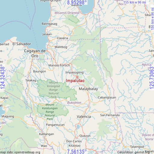
Impalutao GPS coordinates[2]
8° 15' 28.008" North, 125° 1' 39" East
| Map corner | latitude | longitude |
|---|---|---|
| Upper-left | 8.95298°, | 124.32438° |
| Center: | 8.25778°, | 125.0275° |
| Lower-right: | 7.56135°, | 125.73063° |
| Map W x H: | 154.7×154.7 km | = 96.1×96.1mi |
| max Lat: | 20.78733° ⇑80.3% North |
| Impalutao: | 8.25778° |
| min Lat: | ⇓19.7% South 4.65442° |
| min Long | Impalutao | max Long |
| 117.04868° | 125.0275° | 126.58417° |
| W 88.2%⇐ | ⇒11.8% E |
Elevation
Elevation of Impalutao is 749 m = 2457 ft, and this is 661.1 m = 2169 ft above average elevation for this country.
| Max E: |
2262 m = 7421 ft | 1.9% |
| Impalutao | 749 m 2457 ft | |
| Avg. | 87.9 m = 288 ft | |
Min E: |
-2 m = -7 ft | 98.1% |
See also: Philippines elevation on elevation.city.
Geographical zone
Impalutao is located in North Torrid zone (between Equator and Tropic of Cancer). Distance of Equator is 918.2 km =570.5 mi to South.| Distance of | km | miles | from Impalutao |
|---|---|---|---|
| North Pole | 9088.9 | 5647.6 | to North |
| Arctic Circle | 6483 | 4028.3 | to North |
| Tropic Cancer | 1687.7 | 1048.7 | to North |
| Equator | 918.2 | 570.5 | to South |


Nearby cities:
15 places around Impalutao: (largest is in red/bold)
• Canayan
14.6 km =9.1 mi,  118°
118°
• Casisang
17.1 km =10.6 mi,  141°
141°
• Dalirig
19.2 km =11.9 mi,  313°
313°
• Dalwangan
6.5 km =4 mi,  167°
167°
• Dumalaguing
10.4 km =6.5 mi,  16°
16°
• Kalugmanan
18.6 km =11.6 mi,  276°
276°
• Kisolon
9.8 km =6.1 mi,  325°
325°
• La Fortuna
3.8 km =2.4 mi, 310°
• Malaybalay
15.7 km =9.8 mi, 135°
• Maluko
15.3 km =9.5 mi, 328°
• Manolo Fortich
21.8 km =13.5 mi,  304°
304°
• Pontian
14.2 km =8.8 mi, 280°
• Sankanan
19.7 km =12.2 mi,  289°
289°
• Sumilao
9.6 km =6 mi, 289°
• Sumpong
14.5 km =9 mi, 136°
Sources, notices
• [Note1] Compared only with cities in Philippines existing in our database
• [Src1] Map data: © OpenStreetMap contributors (CC-BY-SA)
• [Src2] Other city data from geonames.org with taken over terms of usage.
• [Src3] Geographical zone / Annual Mean Temperature by Robert A. Rohde @ Wikipedia
