Canayan geodata
Canayan (Northern Mindanao) is a populated place; located in Philippines in Asia/Manila (GMT+8) time zone. With population of 4,639 people, there are 1435 cities with bigger population in this country. Compared to other cities in Philippines, 80.7% of cities are located further ↑North; 89.7% of cities are located further ←West and 97.3% of cities have lower elevation than Canayan. Note1
Administrative division(s):
- Level 1: Northern Mindanao
- Level 2: Province of Bukidnon
- Level 3: City of Malaybalay


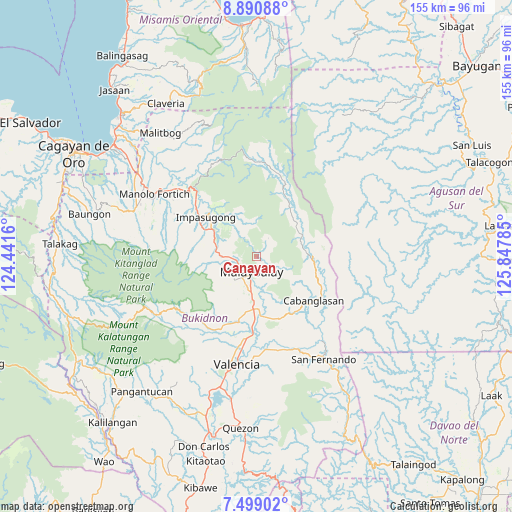
Canayan GPS coordinates[2]
8° 11' 44.016" North, 125° 8' 40.992" East
| Map corner | latitude | longitude |
|---|---|---|
| Upper-left | 8.89088°, | 124.4416° |
| Center: | 8.19556°, | 125.14472° |
| Lower-right: | 7.49902°, | 125.84785° |
| Map W x H: | 154.8×154.8 km | = 96.2×96.2mi |
| max Lat: | 20.78733° ⇑80.7% North |
| Canayan: | 8.19556° |
| min Lat: | ⇓19.3% South 4.65442° |
| min Long | Canayan | max Long |
| 117.04868° | 125.14472° | 126.58417° |
| W 89.7%⇐ | ⇒10.3% E |
Elevation
Elevation of Canayan is 661 m = 2169 ft, and this is 573.1 m = 1880 ft above average elevation for this country.
| Max E: |
2262 m = 7421 ft | 2.7% |
| Canayan | 661 m 2169 ft | |
| Avg. | 87.9 m = 288 ft | |
Min E: |
-2 m = -7 ft | 97.3% |
See also: Philippines elevation on elevation.city.
Geographical zone
Canayan is located in North Torrid zone (between Equator and Tropic of Cancer). Distance of Equator is 911.3 km =566.3 mi to South.| Distance of | km | miles | from Canayan |
|---|---|---|---|
| North Pole | 9095.8 | 5651.9 | to North |
| Arctic Circle | 6489.9 | 4032.6 | to North |
| Tropic Cancer | 1694.7 | 1053 | to North |
| Equator | 911.3 | 566.3 | to South |


Nearby cities:
15 places around Canayan: (largest is in red/bold)
• Aglayan
15.7 km =9.8 mi,  184°
184°
• Bugcaon
17 km =10.6 mi,  191°
191°
• Busdi
14.8 km =9.2 mi,  52°
52°
• Cabangahan
19.2 km =11.9 mi, 182°
• Casisang
6.8 km =4.2 mi,  198°
198°
• Dalwangan
11.5 km =7.1 mi,  272°
272°
• Dumalaguing
19.5 km =12.1 mi,  329°
329°
• Impalutao
14.6 km =9.1 mi,  298°
298°
• La Fortuna
18.3 km =11.4 mi, 300°
• Laguitas
11.9 km =7.4 mi, 187°
• Linabo
15.8 km =9.8 mi, 175°
• Malaybalay
4.6 km =2.9 mi, 203°
• Managok
19.2 km =11.9 mi,  165°
165°
• Silae
15.7 km =9.8 mi,  105°
105°
• Sumpong
4.6 km =2.9 mi,  219°
219°
Sources, notices
• [Note1] Compared only with cities in Philippines existing in our database
• [Src1] Map data: © OpenStreetMap contributors (CC-BY-SA)
• [Src2] Other city data from geonames.org with taken over terms of usage.
• [Src3] Geographical zone / Annual Mean Temperature by Robert A. Rohde @ Wikipedia
