Kumalisquis geodata
Kumalisquis (Western Visayas) is a populated place; located in Philippines in Asia/Manila (GMT+8) time zone. With population of 2,837 people, there are 2727 cities with bigger population in this country. Compared to other cities in Philippines, 63.2% of cities are located further ↑North; 56.7% of cities are located further ←West and 96.7% of cities have lower elevation than Kumalisquis. Note1
Administrative division(s):
- Level 1: Western Visayas
- Level 2: Province of Negros Occidental
- Level 3: San Carlos City


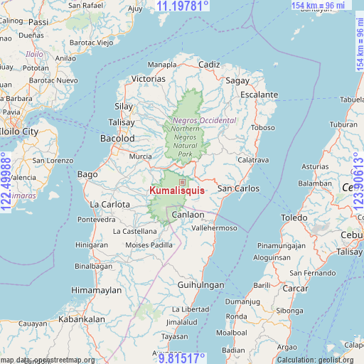
Kumalisquis GPS coordinates[2]
10° 30' 26.136" North, 123° 12' 10.8" East
| Map corner | latitude | longitude |
|---|---|---|
| Upper-left | 11.19781°, | 122.49988° |
| Center: | 10.50726°, | 123.203° |
| Lower-right: | 9.81517°, | 123.90613° |
| Map W x H: | 153.7×153.7 km | = 95.5×95.5mi |
| max Lat: | 20.78733° ⇑63.2% North |
| Kumalisquis: | 10.50726° |
| min Lat: | ⇓36.8% South 4.65442° |
| min Long | Kumalisquis | max Long |
| 117.04868° | 123.203° | 126.58417° |
| W 56.7%⇐ | ⇒43.3% E |
Elevation
Elevation of Kumalisquis is 577 m = 1893 ft, and this is 489.1 m = 1605 ft above average elevation for this country.
| Max E: |
2262 m = 7421 ft | 3.3% |
| Kumalisquis | 577 m 1893 ft | |
| Avg. | 87.9 m = 288 ft | |
Min E: |
-2 m = -7 ft | 96.7% |
See also: Philippines elevation on elevation.city.
Geographical zone
Kumalisquis is located in North Torrid zone (between Equator and Tropic of Cancer). Distance of Equator is 1168.3 km =725.9 mi to South.| Distance of | km | miles | from Kumalisquis |
|---|---|---|---|
| North Pole | 8838.8 | 5492.2 | to North |
| Arctic Circle | 6232.9 | 3872.9 | to North |
| Tropic Cancer | 1437.6 | 893.3 | to North |
| Equator | 1168.3 | 725.9 | to South |


Nearby cities:
15 places around Kumalisquis: (largest is in red/bold)
• Araal
20 km =12.4 mi,  240°
240°
• Buenavista
16.5 km =10.3 mi,  316°
316°
• Buluangan
19.9 km =12.4 mi,  132°
132°
• Canlaon
13.5 km =8.4 mi,  170°
170°
• Codcod
7 km =4.3 mi, 133°
• Guadalupe
19.5 km =12.1 mi,  107°
107°
• Hacienda Santa Rosa
13.3 km =8.3 mi,  303°
303°
• Igmaya-an
5.1 km =3.2 mi,  22°
22°
• Minuyan
10.7 km =6.6 mi,  273°
273°
• New Pandanon
8.2 km =5.1 mi,  312°
312°
• Prosperidad
11.6 km =7.2 mi,  85°
85°
• Quezon
10.1 km =6.3 mi,  141°
141°
• San Miguel
13.6 km =8.5 mi,  284°
284°
• Santa Cruz
19.3 km =12 mi, 316°
• Yubo
19.6 km =12.2 mi,  228°
228°
Sources, notices
• [Note1] Compared only with cities in Philippines existing in our database
• [Src1] Map data: © OpenStreetMap contributors (CC-BY-SA)
• [Src2] Other city data from geonames.org with taken over terms of usage.
• [Src3] Geographical zone / Annual Mean Temperature by Robert A. Rohde @ Wikipedia
