Kayapa geodata
Kayapa (Cagayan Valley) is a seat of a third-order administrative division; located in Philippines in Asia/Manila (GMT+8) time zone. In our database, there are 4166 cities with bigger population. Compared to other cities in Philippines, 90.3% of cities are located further ↓South; 79.8% of cities are located further →East and 99.2% of cities have lower elevation than Kayapa. Note1
Administrative division(s):
- Level 1: Cagayan Valley
- Level 2: Province of Nueva Vizcaya
- Level 3: Kayapa


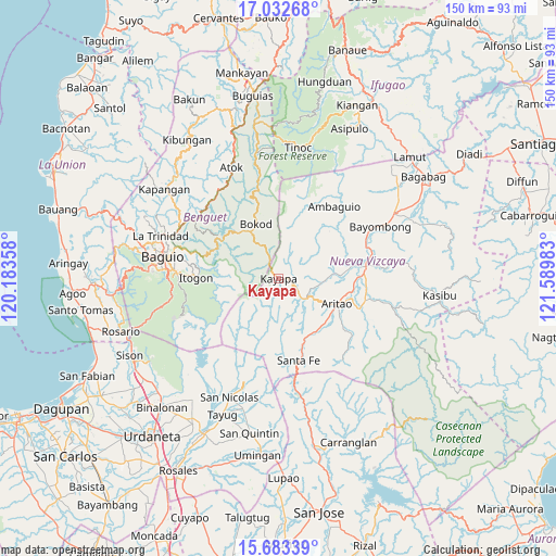
Kayapa GPS coordinates[2]
16° 21' 33.12" North, 120° 53' 12.12" East
| Map corner | latitude | longitude |
|---|---|---|
| Upper-left | 17.03268°, | 120.18358° |
| Center: | 16.3592°, | 120.8867° |
| Lower-right: | 15.68339°, | 121.58983° |
| Map W x H: | 150×150 km | = 93.2×93.2mi |
| max Lat: | 20.78733° ⇑9.7% North |
| Kayapa: | 16.3592° |
| min Lat: | ⇓90.3% South 4.65442° |
| min Long | Kayapa | max Long |
| 117.04868° | 120.8867° | 126.58417° |
| W 20.2%⇐ | ⇒79.8% E |
Elevation
Elevation of Kayapa is 1109 m = 3638 ft, and this is 1021.1 m = 3350 ft above average elevation for this country.
| Max E: |
2262 m = 7421 ft | 0.8% |
| Kayapa | 1109 m 3638 ft | |
| Avg. | 87.9 m = 288 ft | |
Min E: |
-2 m = -7 ft | 99.2% |
See also: Philippines elevation on elevation.city.
Geographical zone
Kayapa is located in North Torrid zone (between Equator and Tropic of Cancer). Distance of this Northern Tropic circle is 786.9 km =489 mi to North.| Distance of | km | miles | from Kayapa |
|---|---|---|---|
| North Pole | 8188.1 | 5087.8 | to North |
| Arctic Circle | 5582.2 | 3468.6 | to North |
| Tropic Cancer | 786.9 | 489 | to North |
| Equator | 1819 | 1130.3 | to South |


Nearby cities:
15 places around Kayapa: (largest is in red/bold)
• Almaguer North
22 km =13.7 mi,  92°
92°
• Ambuclao
20.1 km =12.5 mi,  313°
313°
• Aritao
17.2 km =10.7 mi,  113°
113°
• Bambang
23.7 km =14.7 mi,  82°
82°
• Banganan
18.6 km =11.6 mi, 105°
• Bokod
15.6 km =9.7 mi,  337°
337°
• Bone South
17.3 km =10.7 mi,  137°
137°
• Dalupirip
17.7 km =11 mi,  257°
257°
• Ineangan
22.5 km =14 mi,  101°
101°
• Itogon
22.4 km =13.9 mi,  271°
271°
• Mabasa
25.9 km =16.1 mi, 99°
• Malasin
24.2 km =15 mi, 104°
• Salinas
14.1 km =8.8 mi, 85°
• San Antonio
23.8 km =14.8 mi, 92°
• Santa Fe
22.9 km =14.2 mi,  166°
166°
Sources, notices
• [Note1] Compared only with cities in Philippines existing in our database
• [Src1] Map data: © OpenStreetMap contributors (CC-BY-SA)
• [Src2] Other city data from geonames.org with taken over terms of usage.
• [Src3] Geographical zone / Annual Mean Temperature by Robert A. Rohde @ Wikipedia
