Karungdong geodata
Karungdong (Autonomous Region in Muslim Mindanao) is a populated place; located in Philippines in Asia/Manila (GMT+8) time zone. With population of 7,269 people, there are 860 cities with bigger population in this country. Compared to other cities in Philippines, 98.8% of cities are located further ↑North; 70.7% of cities are located further →East and 85.4% of cities have higher elevation than Karungdong. Note1
Administrative division(s):
- Level 1: Autonomous Region in Muslim Mindanao
- Level 2: Province of Sulu
- Level 3: Kalingalan Caluang


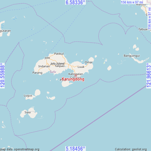
Karungdong GPS coordinates[2]
5° 53' 3.84" North, 121° 15' 46.8" East
| Map corner | latitude | longitude |
|---|---|---|
| Upper-left | 6.58336°, | 120.55988° |
| Center: | 5.8844°, | 121.263° |
| Lower-right: | 5.18456°, | 121.96613° |
| Map W x H: | 155.5×155.5 km | = 96.6×96.6mi |
| max Lat: | 20.78733° ⇑98.8% North |
| Karungdong: | 5.8844° |
| min Lat: | ⇓1.2% South 4.65442° |
| min Long | Karungdong | max Long |
| 117.04868° | 121.263° | 126.58417° |
| W 29.3%⇐ | ⇒70.7% E |
Elevation
Elevation of Karungdong is 8 m = 26 ft, and this is 79.9 m = 262 ft below average elevation for this country.
| Max E: |
2262 m = 7421 ft | 85.4% |
| Avg. | 87.9 m = 288 ft | |
| Karungdong | 8 m = 26 ft | |
Min E: |
-2 m = -7 ft | 14.6% |
See also: Philippines elevation on elevation.city.
Geographical zone
Karungdong is located in North Torrid zone (between Equator and Tropic of Cancer). Distance of Equator is 654.3 km =406.6 mi to South.| Distance of | km | miles | from Karungdong |
|---|---|---|---|
| North Pole | 9352.8 | 5811.6 | to North |
| Arctic Circle | 6746.9 | 4192.3 | to North |
| Tropic Cancer | 1951.6 | 1212.7 | to North |
| Equator | 654.3 | 406.6 | to South |


Nearby cities:
15 places around Karungdong: (largest is in red/bold)
• Andalan
16.4 km =10.2 mi,  59°
59°
• Kalang
11.7 km =7.3 mi,  70°
70°
• Kambing
8.5 km =5.3 mi,  35°
35°
• Kanlagay
3.3 km =2.1 mi,  107°
107°
• Kansipati
13.4 km =8.3 mi,  346°
346°
• Kulay-Kulay
7.6 km =4.7 mi,  333°
333°
• Lu-uk
10.8 km =6.7 mi,  30°
30°
• Mahala
14.8 km =9.2 mi,  284°
284°
• New Panamao
10.1 km =6.3 mi,  316°
316°
• Pananaw
12 km =7.5 mi, 333°
• Pandakan
15.8 km =9.8 mi, 317°
• Pang
7.6 km =4.7 mi,  21°
21°
• Pitogo
5.5 km =3.4 mi,  85°
85°
• Punay
11.2 km =7 mi, 320°
• Tunggol
12.8 km =8 mi,  249°
249°
Sources, notices
• [Note1] Compared only with cities in Philippines existing in our database
• [Src1] Map data: © OpenStreetMap contributors (CC-BY-SA)
• [Src2] Other city data from geonames.org with taken over terms of usage.
• [Src3] Geographical zone / Annual Mean Temperature by Robert A. Rohde @ Wikipedia
