Dumangas geodata
Dumangas (Western Visayas) is a seat of a third-order administrative division; located in Philippines in Asia/Manila (GMT+8) time zone. With population of 8,959 people, there are 692 cities with bigger population in this country. Compared to other cities in Philippines, 59.1% of cities are located further ↑North; 51.3% of cities are located further →East and 89.7% of cities have higher elevation than Dumangas. Note1


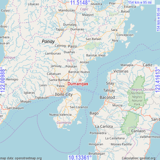
Dumangas GPS coordinates[2]
10° 49' 30" North, 122° 42' 46.8" East
| Map corner | latitude | longitude |
|---|---|---|
| Upper-left | 11.5148°, | 122.00988° |
| Center: | 10.825°, | 122.713° |
| Lower-right: | 10.13361°, | 123.41613° |
| Map W x H: | 153.6×153.6 km | = 95.4×95.4mi |
| max Lat: | 20.78733° ⇑59.1% North |
| Dumangas: | 10.825° |
| min Lat: | ⇓40.9% South 4.65442° |
| min Long | Dumangas | max Long |
| 117.04868° | 122.713° | 126.58417° |
| W 48.7%⇐ | ⇒51.3% E |
Elevation
Elevation of Dumangas is 7 m = 23 ft, and this is 80.9 m = 265 ft below average elevation for this country.
| Max E: |
2262 m = 7421 ft | 89.7% |
| Avg. | 87.9 m = 288 ft | |
| Dumangas | 7 m = 23 ft | |
Min E: |
-2 m = -7 ft | 10.3% |
See also: Philippines elevation on elevation.city.
Geographical zone
Dumangas is located in North Torrid zone (between Equator and Tropic of Cancer). Distance of Equator is 1203.6 km =747.9 mi to South.| Distance of | km | miles | from Dumangas |
|---|---|---|---|
| North Pole | 8803.4 | 5470.2 | to North |
| Arctic Circle | 6197.5 | 3850.9 | to North |
| Tropic Cancer | 1402.3 | 871.3 | to North |
| Equator | 1203.6 | 747.9 | to South |


Nearby cities:
15 places around Dumangas: (largest is in red/bold)
• Barotac Nuevo
7.7 km =4.8 mi,  353°
353°
• Bolilao
6.9 km =4.3 mi,  18°
18°
• Cabilauan
9.5 km =5.9 mi,  321°
321°
• Ermita
8.3 km =5.2 mi,  2°
2°
• Getulio
10.1 km =6.3 mi,  210°
210°
• Igang
13 km =8.1 mi, 321°
• Jalaud
8.2 km =5.1 mi,  284°
284°
• Jalaud
8.5 km =5.3 mi,  26°
26°
• Jamabalod
11.7 km =7.3 mi,  300°
300°
• Monpon
12.7 km =7.9 mi, 319°
• Pasil
11.4 km =7.1 mi, 277°
• Sulangan
2.6 km =1.6 mi, 282°
• Tiwi
11.9 km =7.4 mi,  11°
11°
• Tumcon Ilawod
11.4 km =7.1 mi,  333°
333°
• Zarraga
11.5 km =7.1 mi,  267°
267°
Sources, notices
• [Note1] Compared only with cities in Philippines existing in our database
• [Src1] Map data: © OpenStreetMap contributors (CC-BY-SA)
• [Src2] Other city data from geonames.org with taken over terms of usage.
• [Src3] Geographical zone / Annual Mean Temperature by Robert A. Rohde @ Wikipedia
