Flora geodata
Flora (Cordillera) is a populated place; located in Philippines in Asia/Manila (GMT+8) time zone. With population of 4,213 people, there are 1623 cities with bigger population in this country. Compared to other cities in Philippines, 99% of cities are located further ↓South; 68.2% of cities are located further →East and 76.2% of cities have lower elevation than Flora. Note1


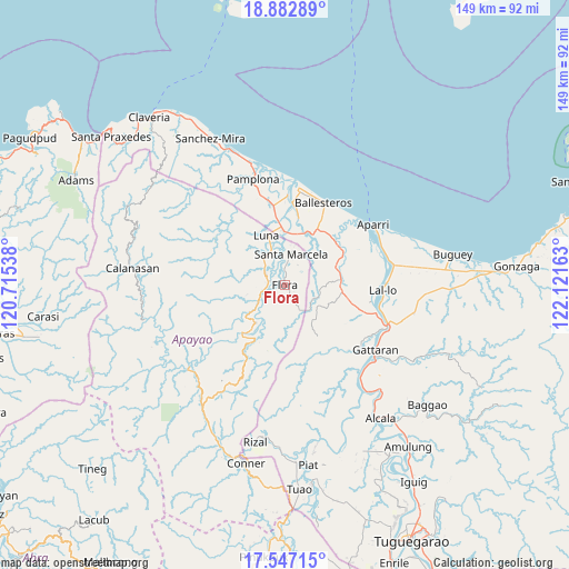
Flora GPS coordinates[2]
18° 12' 58.68" North, 121° 25' 6.6" East
| Map corner | latitude | longitude |
|---|---|---|
| Upper-left | 18.88289°, | 120.71538° |
| Center: | 18.2163°, | 121.4185° |
| Lower-right: | 17.54715°, | 122.12163° |
| Map W x H: | 148.5×148.5 km | = 92.3×92.3mi |
| max Lat: | 20.78733° ⇑1% North |
| Flora: | 18.2163° |
| min Lat: | ⇓99% South 4.65442° |
| min Long | Flora | max Long |
| 117.04868° | 121.4185° | 126.58417° |
| W 31.8%⇐ | ⇒68.2% E |
Elevation
Elevation of Flora is 73 m = 240 ft, and this is 14.9 m = 49 ft below average elevation for this country.
| Max E: |
2262 m = 7421 ft | 23.8% |
| Avg. | 87.9 m = 288 ft | |
| Flora | 73 m = 240 ft | |
Min E: |
-2 m = -7 ft | 76.2% |
See also: Philippines elevation on elevation.city.
Geographical zone
Flora is located in North Torrid zone (between Equator and Tropic of Cancer). Distance of this Northern Tropic circle is 580.5 km =360.7 mi to North.| Distance of | km | miles | from Flora |
|---|---|---|---|
| North Pole | 7981.6 | 4959.5 | to North |
| Arctic Circle | 5375.7 | 3340.3 | to North |
| Tropic Cancer | 580.5 | 360.7 | to North |
| Equator | 2025.5 | 1258.6 | to South |


Nearby cities:
15 places around Flora: (largest is in red/bold)
• Alannay
24.7 km =15.3 mi,  134°
134°
• Allacapan
14.6 km =9.1 mi,  85°
85°
• Bagu
24.1 km =15 mi,  344°
344°
• Ballesteros
24.1 km =15 mi,  25°
25°
• Binalan
18.2 km =11.3 mi,  47°
47°
• Cabaritan East
23.6 km =14.7 mi,  18°
18°
• Calog Norte
16.7 km =10.4 mi,  347°
347°
• Catayauan
25.5 km =15.8 mi,  104°
104°
• Guiddam
14.1 km =8.8 mi, 20°
• Lasam
25.5 km =15.8 mi, 131°
• Lucban
13.4 km =8.3 mi,  5°
5°
• Luna
14 km =8.7 mi,  330°
330°
• Mabuttal East
20.5 km =12.7 mi, 29°
• Nabannagan West
20.3 km =12.6 mi,  142°
142°
• Santa Marcela
7.6 km =4.7 mi, 11°
Sources, notices
• [Note1] Compared only with cities in Philippines existing in our database
• [Src1] Map data: © OpenStreetMap contributors (CC-BY-SA)
• [Src2] Other city data from geonames.org with taken over terms of usage.
• [Src3] Geographical zone / Annual Mean Temperature by Robert A. Rohde @ Wikipedia
