Mabuttal East geodata
Mabuttal East (Cagayan Valley) is a populated place; located in Philippines in Asia/Manila (GMT+8) time zone. With population of 2,342 people, there are 3580 cities with bigger population in this country. Compared to other cities in Philippines, 99.5% of cities are located further ↓South; 66.3% of cities are located further →East and 67.4% of cities have higher elevation than Mabuttal East. Note1
Administrative division(s):
- Level 1: Cagayan Valley
- Level 2: Province of Cagayan
- Level 3: Ballesteros


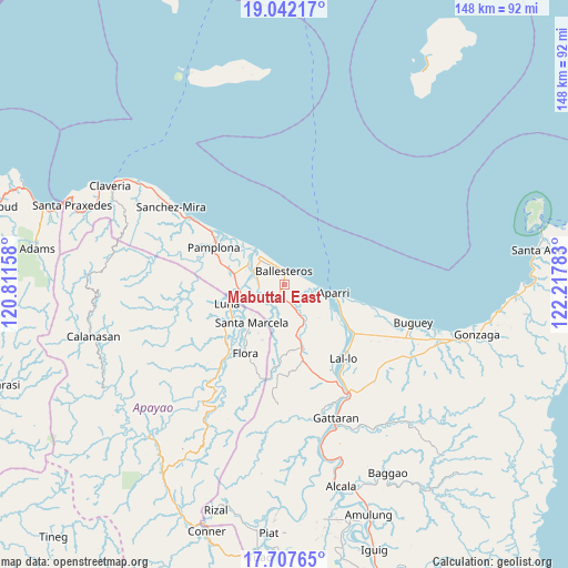
Mabuttal East GPS coordinates[2]
18° 22' 34.32" North, 121° 30' 52.92" East
| Map corner | latitude | longitude |
|---|---|---|
| Upper-left | 19.04217°, | 120.81158° |
| Center: | 18.3762°, | 121.5147° |
| Lower-right: | 17.70765°, | 122.21783° |
| Map W x H: | 148.4×148.4 km | = 92.2×92.2mi |
| max Lat: | 20.78733° ⇑0.5% North |
| Mabuttal East: | 18.3762° |
| min Lat: | ⇓99.5% South 4.65442° |
| min Long | Mabuttal East | max Long |
| 117.04868° | 121.5147° | 126.58417° |
| W 33.7%⇐ | ⇒66.3% E |
Elevation
Elevation of Mabuttal East is 13 m = 43 ft, and this is 74.9 m = 246 ft below average elevation for this country.
| Max E: |
2262 m = 7421 ft | 67.4% |
| Avg. | 87.9 m = 288 ft | |
| Mabuttal East | 13 m = 43 ft | |
Min E: |
-2 m = -7 ft | 32.6% |
See also: Philippines elevation on elevation.city.
Geographical zone
Mabuttal East is located in North Torrid zone (between Equator and Tropic of Cancer). Distance of this Northern Tropic circle is 562.7 km =349.6 mi to North.| Distance of | km | miles | from Mabuttal East |
|---|---|---|---|
| North Pole | 7963.8 | 4948.5 | to North |
| Arctic Circle | 5357.9 | 3329.2 | to North |
| Tropic Cancer | 562.7 | 349.6 | to North |
| Equator | 2043.2 | 1269.6 | to South |


Nearby cities:
15 places around Mabuttal East: (largest is in red/bold)
• Abulug
10 km =6.2 mi,  319°
319°
• Allacapan
17.3 km =10.7 mi,  165°
165°
• Aparri
13.5 km =8.4 mi,  99°
99°
• Bagu
17.6 km =10.9 mi,  287°
287°
• Ballesteros
4 km =2.5 mi,  0°
0°
• Binalan
6.3 km =3.9 mi,  149°
149°
• Cabaritan East
5.4 km =3.4 mi,  329°
329°
• Calog Norte
13.7 km =8.5 mi,  264°
264°
• Camalaniugan
20.4 km =12.7 mi,  123°
123°
• Flora
20.5 km =12.7 mi,  209°
209°
• Guiddam
6.9 km =4.3 mi,  228°
228°
• Lucban
9.9 km =6.2 mi,  243°
243°
• Luna
17.9 km =11.1 mi,  251°
251°
• Pamplona
20.9 km =13 mi,  298°
298°
• Santa Marcela
13.4 km =8.3 mi,  219°
219°
Sources, notices
• [Note1] Compared only with cities in Philippines existing in our database
• [Src1] Map data: © OpenStreetMap contributors (CC-BY-SA)
• [Src2] Other city data from geonames.org with taken over terms of usage.
• [Src3] Geographical zone / Annual Mean Temperature by Robert A. Rohde @ Wikipedia
