Cabaritan East geodata
Cabaritan East (Cagayan Valley) is a populated place; located in Philippines in Asia/Manila (GMT+8) time zone. With population of 9,348 people, there are 660 cities with bigger population in this country. Compared to other cities in Philippines, 99.5% of cities are located further ↓South; 66.6% of cities are located further →East and 89.7% of cities have higher elevation than Cabaritan East. Note1
Administrative division(s):
- Level 1: Cagayan Valley
- Level 2: Province of Cagayan
- Level 3: Ballesteros


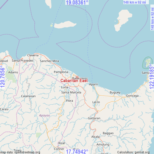
Cabaritan East GPS coordinates[2]
18° 25' 4.116" North, 121° 29' 19.392" East
| Map corner | latitude | longitude |
|---|---|---|
| Upper-left | 19.08361°, | 120.7856° |
| Center: | 18.41781°, | 121.48872° |
| Lower-right: | 17.74942°, | 122.19185° |
| Map W x H: | 148.3×148.4 km | = 92.1×92.2mi |
| max Lat: | 20.78733° ⇑0.5% North |
| Cabaritan East: | 18.41781° |
| min Lat: | ⇓99.5% South 4.65442° |
| min Long | Cabaritan East | max Long |
| 117.04868° | 121.48872° | 126.58417° |
| W 33.4%⇐ | ⇒66.6% E |
Elevation
Elevation of Cabaritan East is 7 m = 23 ft, and this is 80.9 m = 265 ft below average elevation for this country.
| Max E: |
2262 m = 7421 ft | 89.7% |
| Avg. | 87.9 m = 288 ft | |
| Cabaritan East | 7 m = 23 ft | |
Min E: |
-2 m = -7 ft | 10.3% |
See also: Philippines elevation on elevation.city.
Geographical zone
Cabaritan East is located in North Torrid zone (between Equator and Tropic of Cancer). Distance of this Northern Tropic circle is 558.1 km =346.8 mi to North.| Distance of | km | miles | from Cabaritan East |
|---|---|---|---|
| North Pole | 7959.2 | 4945.6 | to North |
| Arctic Circle | 5353.3 | 3326.4 | to North |
| Tropic Cancer | 558.1 | 346.8 | to North |
| Equator | 2047.9 | 1272.5 | to South |


Nearby cities:
15 places around Cabaritan East: (largest is in red/bold)
• Abulug
4.8 km =3 mi,  309°
309°
• Allacapan
22.5 km =14 mi,  161°
161°
• Aparri
17.4 km =10.8 mi,  113°
113°
• Bagu
14 km =8.7 mi,  272°
272°
• Ballesteros
2.9 km =1.8 mi,  101°
101°
• Binalan
11.7 km =7.3 mi,  149°
149°
• Calog Norte
12.5 km =7.8 mi,  241°
241°
• Flora
23.6 km =14.7 mi,  198°
198°
• Guiddam
9.5 km =5.9 mi,  194°
194°
• Lucban
10.9 km =6.8 mi,  214°
214°
• Luna
17.5 km =10.9 mi,  234°
234°
• Mabuttal East
5.4 km =3.4 mi, 149°
• Pamplona
16.5 km =10.3 mi,  289°
289°
• Santa Cruz
21.8 km =13.5 mi,  300°
300°
• Santa Marcela
16.1 km =10 mi, 201°
Sources, notices
• [Note1] Compared only with cities in Philippines existing in our database
• [Src1] Map data: © OpenStreetMap contributors (CC-BY-SA)
• [Src2] Other city data from geonames.org with taken over terms of usage.
• [Src3] Geographical zone / Annual Mean Temperature by Robert A. Rohde @ Wikipedia
