Santa Cruz geodata
Santa Cruz (Davao) is a seat of a third-order administrative division; located in Philippines in Asia/Manila (GMT+8) time zone. In our database, there are 4166 cities with bigger population. Compared to other cities in Philippines, 93% of cities are located further ↑North; 92.2% of cities are located further ←West and 70.2% of cities have higher elevation than Santa Cruz. Note1


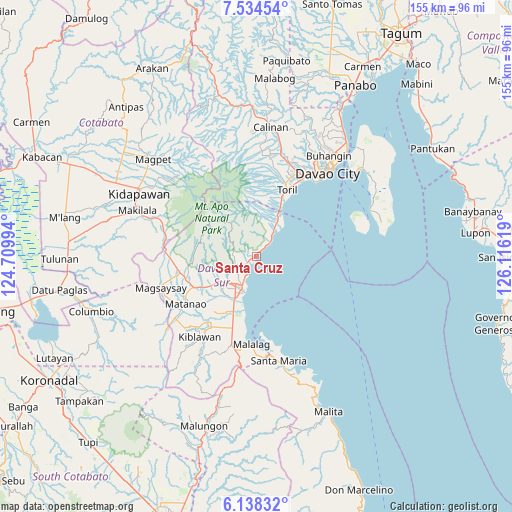
Santa Cruz GPS coordinates[2]
6° 50' 12.984" North, 125° 24' 47.016" East
| Map corner | latitude | longitude |
|---|---|---|
| Upper-left | 7.53454°, | 124.70994° |
| Center: | 6.83694°, | 125.41306° |
| Lower-right: | 6.13832°, | 126.11619° |
| Map W x H: | 155.2×155.2 km | = 96.4×96.4mi |
| max Lat: | 20.78733° ⇑93% North |
| Santa Cruz: | 6.83694° |
| min Lat: | ⇓7% South 4.65442° |
| min Long | Santa Cruz | max Long |
| 117.04868° | 125.41306° | 126.58417° |
| W 92.2%⇐ | ⇒7.8% E |
Elevation
Elevation of Santa Cruz is 12 m = 39 ft, and this is 75.9 m = 249 ft below average elevation for this country.
| Max E: |
2262 m = 7421 ft | 70.2% |
| Avg. | 87.9 m = 288 ft | |
| Santa Cruz | 12 m = 39 ft | |
Min E: |
-2 m = -7 ft | 29.8% |
See also: Philippines elevation on elevation.city.
Geographical zone
Santa Cruz is located in North Torrid zone (between Equator and Tropic of Cancer). Distance of Equator is 760.2 km =472.4 mi to South.| Distance of | km | miles | from Santa Cruz |
|---|---|---|---|
| North Pole | 9246.9 | 5745.8 | to North |
| Arctic Circle | 6641 | 4126.5 | to North |
| Tropic Cancer | 1845.7 | 1146.9 | to North |
| Equator | 760.2 | 472.4 | to South |


Nearby cities:
15 places around Santa Cruz: (largest is in red/bold)
• Astorga
9.1 km =5.7 mi,  31°
31°
• Balutakay
14.6 km =9.1 mi,  207°
207°
• Baracatan
14.5 km =9 mi,  1°
1°
• Coronon
6.1 km =3.8 mi,  40°
40°
• Digos
11.5 km =7.1 mi, 212°
• Goma
11.3 km =7 mi,  243°
243°
• Guihing Proper
18.2 km =11.3 mi,  201°
201°
• Hagonoy
19.6 km =12.2 mi, 209°
• Inawayan
15.3 km =9.5 mi, 25°
• Managa
18.9 km =11.7 mi, 237°
• Matti
13.7 km =8.5 mi, 237°
• Sibulan
12 km =7.5 mi, 26°
• Sinayawan
18 km =11.2 mi,  219°
219°
• Takub
2.4 km =1.5 mi, 25°
• Tuban
3.3 km =2.1 mi, 241°
Sources, notices
• [Note1] Compared only with cities in Philippines existing in our database
• [Src1] Map data: © OpenStreetMap contributors (CC-BY-SA)
• [Src2] Other city data from geonames.org with taken over terms of usage.
• [Src3] Geographical zone / Annual Mean Temperature by Robert A. Rohde @ Wikipedia
