Dicabisagan geodata
Dicabisagan (Cagayan Valley) is a populated place; located in Philippines in Asia/Manila (GMT+8) time zone. With population of 3,503 people, there are 2053 cities with bigger population in this country. Compared to other cities in Philippines, 93.9% of cities are located further ↓South; 56% of cities are located further →East and 59.2% of cities have higher elevation than Dicabisagan. Note1


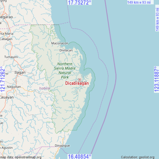
Dicabisagan GPS coordinates[2]
17° 4' 54.624" North, 122° 24' 56.664" East
| Map corner | latitude | longitude |
|---|---|---|
| Upper-left | 17.75272°, | 121.71262° |
| Center: | 17.08184°, | 122.41574° |
| Lower-right: | 16.40854°, | 123.11887° |
| Map W x H: | 149.5×149.5 km | = 92.9×92.9mi |
| max Lat: | 20.78733° ⇑6.1% North |
| Dicabisagan: | 17.08184° |
| min Lat: | ⇓93.9% South 4.65442° |
| min Long | Dicabisagan | max Long |
| 117.04868° | 122.41574° | 126.58417° |
| W 44%⇐ | ⇒56% E |
Elevation
Elevation of Dicabisagan is 17 m = 56 ft, and this is 70.9 m = 233 ft below average elevation for this country.
| Max E: |
2262 m = 7421 ft | 59.2% |
| Avg. | 87.9 m = 288 ft | |
| Dicabisagan | 17 m = 56 ft | |
Min E: |
-2 m = -7 ft | 40.8% |
See also: Philippines elevation on elevation.city.
Geographical zone
Dicabisagan is located in North Torrid zone (between Equator and Tropic of Cancer). Distance of this Northern Tropic circle is 706.6 km =439.1 mi to North.| Distance of | km | miles | from Dicabisagan |
|---|---|---|---|
| North Pole | 8107.7 | 5037.9 | to North |
| Arctic Circle | 5501.9 | 3418.7 | to North |
| Tropic Cancer | 706.6 | 439.1 | to North |
| Equator | 1899.3 | 1180.2 | to South |


Nearby cities:
15 places around Dicabisagan: (largest is in red/bold)
• Alibago
58.5 km =36.4 mi,  273°
273°
• Benito Soliven
49.7 km =30.9 mi,  257°
257°
• Cabannungan Second
60.2 km =37.4 mi, 274°
• Daragutan
41.7 km =25.9 mi, 257°
• Dicamay
56.9 km =35.4 mi,  230°
230°
• Gamu
61.7 km =38.3 mi, 266°
• Ganapi
60 km =37.3 mi,  282°
282°
• Ilagan
56.4 km =35 mi, 277°
• Maluno Sur
48.9 km =30.4 mi, 259°
• Manaring
55.5 km =34.5 mi, 280°
• Minallo
60.7 km =37.7 mi, 259°
• San Mariano
44.1 km =27.4 mi, 255°
• San Pedro
58.1 km =36.1 mi, 283°
• Sindon
42.6 km =26.5 mi, 266°
• Yeban Norte
50.8 km =31.6 mi, 262°
Sources, notices
• [Note1] Compared only with cities in Philippines existing in our database
• [Src1] Map data: © OpenStreetMap contributors (CC-BY-SA)
• [Src2] Other city data from geonames.org with taken over terms of usage.
• [Src3] Geographical zone / Annual Mean Temperature by Robert A. Rohde @ Wikipedia
