Caibiran geodata
Caibiran (Eastern Visayas) is a seat of a third-order administrative division; located in Philippines in Asia/Manila (GMT+8) time zone. With population of 6,462 people, there are 969 cities with bigger population in this country. Compared to other cities in Philippines, 50.6% of cities are located further ↑North; 80.4% of cities are located further ←West and 92.7% of cities have higher elevation than Caibiran. Note1


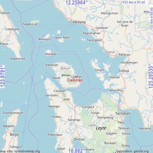
Caibiran GPS coordinates[2]
11° 34' 18.012" North, 124° 34' 55.992" East
| Map corner | latitude | longitude |
|---|---|---|
| Upper-left | 12.25964°, | 123.8791° |
| Center: | 11.57167°, | 124.58222° |
| Lower-right: | 10.882°, | 125.28535° |
| Map W x H: | 153.2×153.2 km | = 95.2×95.2mi |
| max Lat: | 20.78733° ⇑50.6% North |
| Caibiran: | 11.57167° |
| min Lat: | ⇓49.4% South 4.65442° |
| min Long | Caibiran | max Long |
| 117.04868° | 124.58222° | 126.58417° |
| W 80.4%⇐ | ⇒19.6% E |
Elevation
Elevation of Caibiran is 6 m = 20 ft, and this is 81.9 m = 269 ft below average elevation for this country.
| Max E: |
2262 m = 7421 ft | 92.7% |
| Avg. | 87.9 m = 288 ft | |
| Caibiran | 6 m = 20 ft | |
Min E: |
-2 m = -7 ft | 7.3% |
See also: Philippines elevation on elevation.city.
Geographical zone
Caibiran is located in North Torrid zone (between Equator and Tropic of Cancer). Distance of Equator is 1286.6 km =799.5 mi to South.| Distance of | km | miles | from Caibiran |
|---|---|---|---|
| North Pole | 8720.4 | 5418.6 | to North |
| Arctic Circle | 6114.5 | 3799.4 | to North |
| Tropic Cancer | 1319.3 | 819.8 | to North |
| Equator | 1286.6 | 799.5 | to South |


Nearby cities:
15 places around Caibiran: (largest is in red/bold)
• Almeria
22.5 km =14 mi,  283°
283°
• Balagui
12 km =7.5 mi,  206°
206°
• Biliran
16.6 km =10.3 mi,  225°
225°
• Bunga
9.8 km =6.1 mi,  173°
173°
• Cabucgayan
11.1 km =6.9 mi,  184°
184°
• Calubian
21.8 km =13.5 mi, 230°
• Caraycaray
18.3 km =11.4 mi,  264°
264°
• Catmon
17 km =10.6 mi, 256°
• Culaba
10.5 km =6.5 mi,  335°
335°
• Daram
24.2 km =15 mi,  73°
73°
• Leyte
25.2 km =15.7 mi, 205°
• Looc
10.8 km =6.7 mi,  196°
196°
• Naval
20.2 km =12.6 mi,  266°
266°
• Palaroo
21.4 km =13.3 mi, 210°
• Tucdao
18.7 km =11.6 mi,  320°
320°
Sources, notices
• [Note1] Compared only with cities in Philippines existing in our database
• [Src1] Map data: © OpenStreetMap contributors (CC-BY-SA)
• [Src2] Other city data from geonames.org with taken over terms of usage.
• [Src3] Geographical zone / Annual Mean Temperature by Robert A. Rohde @ Wikipedia
