Cagmanaba geodata
Cagmanaba (Bicol) is a populated place; located in Philippines in Asia/Manila (GMT+8) time zone. With population of 2,773 people, there are 2834 cities with bigger population in this country. Compared to other cities in Philippines, 57.8% of cities are located further ↓South; 58.3% of cities are located further ←West and 99.6% of cities have higher elevation than Cagmanaba. Note1


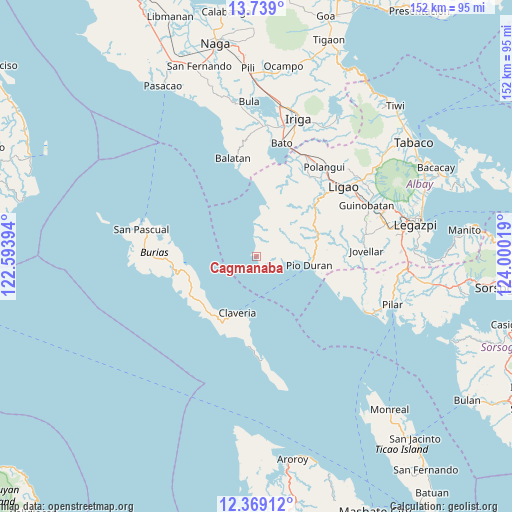
Cagmanaba GPS coordinates[2]
13° 3' 18.036" North, 123° 17' 49.416" East
| Map corner | latitude | longitude |
|---|---|---|
| Upper-left | 13.739°, | 122.59394° |
| Center: | 13.05501°, | 123.29706° |
| Lower-right: | 12.36912°, | 124.00019° |
| Map W x H: | 152.3×152.3 km | = 94.6×94.6mi |
| max Lat: | 20.78733° ⇑42.2% North |
| Cagmanaba: | 13.05501° |
| min Lat: | ⇓57.8% South 4.65442° |
| min Long | Cagmanaba | max Long |
| 117.04868° | 123.29706° | 126.58417° |
| W 58.3%⇐ | ⇒41.7% E |
Elevation
Elevation of Cagmanaba is 1 m = 3 ft, and this is 86.9 m = 285 ft below average elevation for this country.
| Max E: |
2262 m = 7421 ft | 99.6% |
| Avg. | 87.9 m = 288 ft | |
| Cagmanaba | 1 m = 3 ft | |
Min E: |
-2 m = -7 ft | 0.4% |
See also: Philippines elevation on elevation.city.
Geographical zone
Cagmanaba is located in North Torrid zone (between Equator and Tropic of Cancer). Distance of this Northern Tropic circle is 1154.3 km =717.2 mi to North.| Distance of | km | miles | from Cagmanaba |
|---|---|---|---|
| North Pole | 8555.5 | 5316.1 | to North |
| Arctic Circle | 5949.6 | 3696.9 | to North |
| Tropic Cancer | 1154.3 | 717.2 | to North |
| Equator | 1451.6 | 902 | to South |


Nearby cities:
15 places around Cagmanaba: (largest is in red/bold)
• Apud
9.4 km =5.8 mi,  356°
356°
• Badian
2.8 km =1.7 mi,  155°
155°
• Basicao Coastal
11.7 km =7.3 mi,  94°
94°
• Binodegahan
17.4 km =10.8 mi, 87°
• Claveria
17.7 km =11 mi,  198°
198°
• Mabiton
24.9 km =15.5 mi,  188°
188°
• Macabugos
20.2 km =12.6 mi,  2°
2°
• Malidong
18.2 km =11.3 mi,  104°
104°
• Maonon
8.2 km =5.1 mi, 104°
• Pantao
15.8 km =9.8 mi,  11°
11°
• Paulba
22.6 km =14 mi,  52°
52°
• Pio Duran
16.3 km =10.1 mi, 100°
• Sagrada Familia
26.2 km =16.3 mi,  24°
24°
• San Jose
22.7 km =14.1 mi, 20°
• Tambo
22.3 km =13.9 mi, 358°
Sources, notices
• [Note1] Compared only with cities in Philippines existing in our database
• [Src1] Map data: © OpenStreetMap contributors (CC-BY-SA)
• [Src2] Other city data from geonames.org with taken over terms of usage.
• [Src3] Geographical zone / Annual Mean Temperature by Robert A. Rohde @ Wikipedia
