New Corella geodata
New Corella (Davao) is a seat of a third-order administrative division; located in Philippines in Asia/Manila (GMT+8) time zone. With population of 20,574 people, there are 363 cities with bigger population in this country. Compared to other cities in Philippines, 86.1% of cities are located further ↑North; 96.6% of cities are located further ←West and 51.1% of cities have lower elevation than New Corella. Note1
Administrative division(s):
- Level 1: Davao
- Level 2: Province of Davao del Norte
- Level 3: New Corella


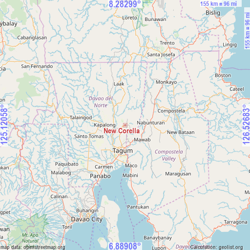
New Corella GPS coordinates[2]
7° 35' 11.76" North, 125° 49' 25.32" East
| Map corner | latitude | longitude |
|---|---|---|
| Upper-left | 8.28299°, | 125.12058° |
| Center: | 7.5866°, | 125.8237° |
| Lower-right: | 6.88908°, | 126.52683° |
| Map W x H: | 155×155 km | = 96.3×96.3mi |
| max Lat: | 20.78733° ⇑86.1% North |
| New Corella: | 7.5866° |
| min Lat: | ⇓13.9% South 4.65442° |
| min Long | New Corella | max Long |
| 117.04868° | 125.8237° | 126.58417° |
| W 96.6%⇐ | ⇒3.4% E |
Elevation
Elevation of New Corella is 24 m = 79 ft, and this is 63.9 m = 210 ft below average elevation for this country.
| Max E: |
2262 m = 7421 ft | 48.9% |
| Avg. | 87.9 m = 288 ft | |
| New Corella | 24 m = 79 ft | |
Min E: |
-2 m = -7 ft | 51.1% |
See also: Philippines elevation on elevation.city.
Geographical zone
New Corella is located in North Torrid zone (between Equator and Tropic of Cancer). Distance of Equator is 843.6 km =524.2 mi to South.| Distance of | km | miles | from New Corella |
|---|---|---|---|
| North Pole | 9163.5 | 5693.9 | to North |
| Arctic Circle | 6557.6 | 4074.7 | to North |
| Tropic Cancer | 1762.4 | 1095.1 | to North |
| Equator | 843.6 | 524.2 | to South |


Nearby cities:
15 places around New Corella: (largest is in red/bold)
• Buclad
10.4 km =6.5 mi,  230°
230°
• Cambanugoy
9.1 km =5.7 mi,  236°
236°
• Del Pilar
2.6 km =1.6 mi,  172°
172°
• Esperanza
14.9 km =9.3 mi,  224°
224°
• Kaligutan
13 km =8.1 mi,  354°
354°
• Limbaan
5.9 km =3.7 mi,  357°
357°
• Magatos
11.2 km =7 mi,  252°
252°
• Magugpo Poblacion
15.6 km =9.7 mi,  187°
187°
• Nabunturan
15.9 km =9.9 mi,  81°
81°
• New Bohol
7.2 km =4.5 mi, 168°
• New Leyte
12.6 km =7.8 mi, 220°
• New Sibonga
12 km =7.5 mi,  103°
103°
• Pag-asa
15.5 km =9.6 mi,  265°
265°
• Pagsabangan
14.3 km =8.9 mi,  214°
214°
• Talomo
12.9 km =8 mi, 239°
Sources, notices
• [Note1] Compared only with cities in Philippines existing in our database
• [Src1] Map data: © OpenStreetMap contributors (CC-BY-SA)
• [Src2] Other city data from geonames.org with taken over terms of usage.
• [Src3] Geographical zone / Annual Mean Temperature by Robert A. Rohde @ Wikipedia
