Magugpo Poblacion geodata
Magugpo Poblacion (Davao) is a populated place; located in Philippines in Asia/Manila (GMT+8) time zone. With population of 233,254 people, there are 42 cities with bigger population in this country. Compared to other cities in Philippines, 87.5% of cities are located further ↑North; 96.6% of cities are located further ←West and 51.1% of cities have lower elevation than Magugpo Poblacion. Note1
Administrative division(s):
- Level 1: Davao
- Level 2: Province of Davao del Norte
- Level 3: City of Tagum


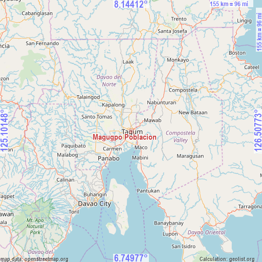
Magugpo Poblacion GPS coordinates[2]
7° 26' 51" North, 125° 48' 16.56" East
| Map corner | latitude | longitude |
|---|---|---|
| Upper-left | 8.14412°, | 125.10148° |
| Center: | 7.4475°, | 125.8046° |
| Lower-right: | 6.74977°, | 126.50773° |
| Map W x H: | 155×155 km | = 96.3×96.3mi |
| max Lat: | 20.78733° ⇑87.5% North |
| Magugpo Poblacion: | 7.4475° |
| min Lat: | ⇓12.5% South 4.65442° |
| min Long | Magugpo Poblaci | max Long |
| 117.04868° | 125.8046° | 126.58417° |
| W 96.6%⇐ | ⇒3.4% E |
Elevation
Elevation of Magugpo Poblacion is 24 m = 79 ft, and this is 63.9 m = 210 ft below average elevation for this country.
| Max E: |
2262 m = 7421 ft | 48.9% |
| Avg. | 87.9 m = 288 ft | |
| Magugpo Poblacion | 24 m = 79 ft | |
Min E: |
-2 m = -7 ft | 51.1% |
See also: Magugpo Poblacion elevation on elevation.city.
Geographical zone
Magugpo Poblacion is located in North Torrid zone (between Equator and Tropic of Cancer). Distance of Equator is 828.1 km =514.6 mi to South.| Distance of | km | miles | from Magugpo Poblacion |
|---|---|---|---|
| North Pole | 9179 | 5703.6 | to North |
| Arctic Circle | 6573.1 | 4084.3 | to North |
| Tropic Cancer | 1777.8 | 1104.7 | to North |
| Equator | 828.1 | 514.6 | to South |


Nearby cities:
15 places around Magugpo Poblacion: (largest is in red/bold)
• Anibongan
11.2 km =7 mi,  237°
237°
• Bincoñgan
10.8 km =6.7 mi,  213°
213°
• Buclad
10.7 km =6.6 mi,  326°
326°
• Cabayangan
9.1 km =5.7 mi, 240°
• Cambanugoy
11.8 km =7.3 mi, 332°
• Corocotan
6.4 km =4 mi, 213°
• Dumlan
8.8 km =5.5 mi,  104°
104°
• Esperanza
9.8 km =6.1 mi,  300°
300°
• Hiju, Maco
7.4 km =4.6 mi,  159°
159°
• Libuganon
11.4 km =7.1 mi,  194°
194°
• Maco
11 km =6.8 mi,  149°
149°
• New Bohol
9.1 km =5.7 mi,  22°
22°
• New Leyte
8.4 km =5.2 mi,  314°
314°
• Pagsabangan
7.1 km =4.4 mi, 301°
• Tuganay
12.5 km =7.8 mi,  225°
225°
Sources, notices
• [Note1] Compared only with cities in Philippines existing in our database
• [Src1] Map data: © OpenStreetMap contributors (CC-BY-SA)
• [Src2] Other city data from geonames.org with taken over terms of usage.
• [Src3] Geographical zone / Annual Mean Temperature by Robert A. Rohde @ Wikipedia
