Borbon geodata
Borbon (Caraga) is a populated place; located in Philippines in Asia/Manila (GMT+8) time zone. With population of 2,105 people, there are 4064 cities with bigger population in this country. Compared to other cities in Philippines, 78.9% of cities are located further ↑North; 97% of cities are located further ←West and 58.1% of cities have lower elevation than Borbon. Note1
Administrative division(s):
- Level 1: Caraga
- Level 2: Province of Agusan del Sur
- Level 3: San Francisco


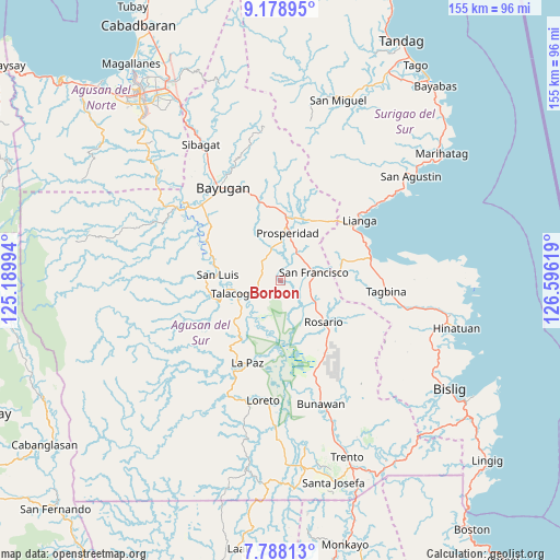
Borbon GPS coordinates[2]
8° 29' 3.012" North, 125° 53' 35.016" East
| Map corner | latitude | longitude |
|---|---|---|
| Upper-left | 9.17895°, | 125.18994° |
| Center: | 8.48417°, | 125.89306° |
| Lower-right: | 7.78813°, | 126.59619° |
| Map W x H: | 154.6×154.6 km | = 96.1×96.1mi |
| max Lat: | 20.78733° ⇑78.9% North |
| Borbon: | 8.48417° |
| min Lat: | ⇓21.1% South 4.65442° |
| min Long | Borbon | max Long |
| 117.04868° | 125.89306° | 126.58417° |
| W 97%⇐ | ⇒3% E |
Elevation
Elevation of Borbon is 31 m = 102 ft, and this is 56.9 m = 187 ft below average elevation for this country.
| Max E: |
2262 m = 7421 ft | 41.9% |
| Avg. | 87.9 m = 288 ft | |
| Borbon | 31 m = 102 ft | |
Min E: |
-2 m = -7 ft | 58.1% |
See also: Philippines elevation on elevation.city.
Geographical zone
Borbon is located in North Torrid zone (between Equator and Tropic of Cancer). Distance of Equator is 943.4 km =586.2 mi to South.| Distance of | km | miles | from Borbon |
|---|---|---|---|
| North Pole | 9063.7 | 5631.9 | to North |
| Arctic Circle | 6457.8 | 4012.7 | to North |
| Tropic Cancer | 1662.6 | 1033.1 | to North |
| Equator | 943.4 | 586.2 | to South |


Nearby cities:
15 places around Borbon: (largest is in red/bold)
• Alegria
13.3 km =8.3 mi,  79°
79°
• Amaga
20.2 km =12.6 mi, 75°
• Aurora
13.6 km =8.5 mi,  333°
333°
• Bah-Bah
13.9 km =8.6 mi,  9°
9°
• Causwagan
7.1 km =4.4 mi,  234°
234°
• Javier
21.1 km =13.1 mi,  88°
88°
• Kauswagan
16.1 km =10 mi,  282°
282°
• Lapinigan
12.1 km =7.5 mi,  125°
125°
• Los Arcos
19.4 km =12.1 mi,  31°
31°
• Patin-ay
8.8 km =5.5 mi, 33°
• Prosperidad
10.7 km =6.6 mi,  1°
1°
• Rosario
16.2 km =10.1 mi, 131°
• San Francisco
8.5 km =5.3 mi,  47°
47°
• San Luis
16.4 km =10.2 mi,  267°
267°
• Talacogon
12.4 km =7.7 mi,  255°
255°
Sources, notices
• [Note1] Compared only with cities in Philippines existing in our database
• [Src1] Map data: © OpenStreetMap contributors (CC-BY-SA)
• [Src2] Other city data from geonames.org with taken over terms of usage.
• [Src3] Geographical zone / Annual Mean Temperature by Robert A. Rohde @ Wikipedia
