Battung geodata
Battung (Cagayan Valley) is a populated place; located in Philippines in Asia/Manila (GMT+8) time zone. With population of 2,350 people, there are 3560 cities with bigger population in this country. Compared to other cities in Philippines, 97.4% of cities are located further ↓South; 67.4% of cities are located further →East and 65.9% of cities have lower elevation than Battung. Note1


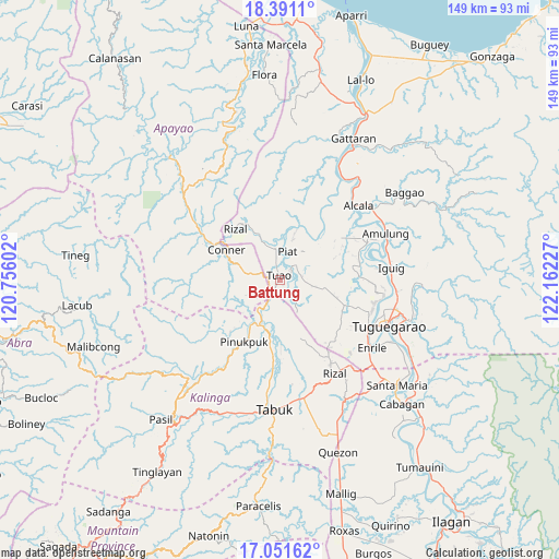
Battung GPS coordinates[2]
17° 43' 21.396" North, 121° 27' 32.904" East
| Map corner | latitude | longitude |
|---|---|---|
| Upper-left | 18.3911°, | 120.75602° |
| Center: | 17.72261°, | 121.45914° |
| Lower-right: | 17.05162°, | 122.16227° |
| Map W x H: | 148.9×148.9 km | = 92.5×92.5mi |
| max Lat: | 20.78733° ⇑2.6% North |
| Battung: | 17.72261° |
| min Lat: | ⇓97.4% South 4.65442° |
| min Long | Battung | max Long |
| 117.04868° | 121.45914° | 126.58417° |
| W 32.6%⇐ | ⇒67.4% E |
Elevation
Elevation of Battung is 43 m = 141 ft, and this is 44.9 m = 147 ft below average elevation for this country.
| Max E: |
2262 m = 7421 ft | 34.1% |
| Avg. | 87.9 m = 288 ft | |
| Battung | 43 m = 141 ft | |
Min E: |
-2 m = -7 ft | 65.9% |
See also: Philippines elevation on elevation.city.
Geographical zone
Battung is located in North Torrid zone (between Equator and Tropic of Cancer). Distance of this Northern Tropic circle is 635.3 km =394.8 mi to North.| Distance of | km | miles | from Battung |
|---|---|---|---|
| North Pole | 8036.5 | 4993.6 | to North |
| Arctic Circle | 5430.6 | 3374.4 | to North |
| Tropic Cancer | 635.3 | 394.8 | to North |
| Equator | 1970.6 | 1224.5 | to South |


Nearby cities:
15 places around Battung: (largest is in red/bold)
• Accusilian
2.8 km =1.7 mi,  7°
7°
• Alabug
1.4 km =0.9 mi,  39°
39°
• Bagumbayan
1.3 km =0.8 mi,  270°
270°
• Conner
16.2 km =10.1 mi,  300°
300°
• Dagupan
5.4 km =3.4 mi,  117°
117°
• Gadu
19.1 km =11.9 mi, 122°
• Iraga
20.8 km =12.9 mi,  96°
96°
• Lallayug
2.5 km =1.6 mi,  226°
226°
• Maguilling
6.7 km =4.2 mi, 37°
• Mungo
1.3 km =0.8 mi,  82°
82°
• Pata
4.6 km =2.9 mi, 100°
• Piat
7.8 km =4.8 mi, 14°
• Pinukpuk
13.3 km =8.3 mi,  208°
208°
• Rizal
18.4 km =11.4 mi,  319°
319°
• Tuao
1.6 km =1 mi,  349°
349°
Sources, notices
• [Note1] Compared only with cities in Philippines existing in our database
• [Src1] Map data: © OpenStreetMap contributors (CC-BY-SA)
• [Src2] Other city data from geonames.org with taken over terms of usage.
• [Src3] Geographical zone / Annual Mean Temperature by Robert A. Rohde @ Wikipedia
