Piat geodata
Piat (Cagayan Valley) is a seat of a third-order administrative division; located in Philippines in Asia/Manila (GMT+8) time zone. With population of 5,958 people, there are 1058 cities with bigger population in this country. Compared to other cities in Philippines, 97.7% of cities are located further ↓South; 66.9% of cities are located further →East and 71.5% of cities have lower elevation than Piat. Note1


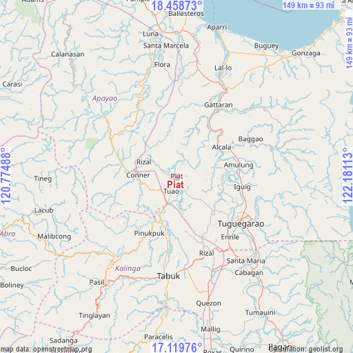
Piat GPS coordinates[2]
17° 47' 25.8" North, 121° 28' 40.8" East
| Map corner | latitude | longitude |
|---|---|---|
| Upper-left | 18.45873°, | 120.77488° |
| Center: | 17.7905°, | 121.478° |
| Lower-right: | 17.11976°, | 122.18113° |
| Map W x H: | 148.9×148.9 km | = 92.5×92.5mi |
| max Lat: | 20.78733° ⇑2.3% North |
| Piat: | 17.7905° |
| min Lat: | ⇓97.7% South 4.65442° |
| min Long | Piat | max Long |
| 117.04868° | 121.478° | 126.58417° |
| W 33.1%⇐ | ⇒66.9% E |
Elevation
Elevation of Piat is 56 m = 184 ft, and this is 31.9 m = 105 ft below average elevation for this country.
| Max E: |
2262 m = 7421 ft | 28.5% |
| Avg. | 87.9 m = 288 ft | |
| Piat | 56 m = 184 ft | |
Min E: |
-2 m = -7 ft | 71.5% |
See also: Philippines elevation on elevation.city.
Geographical zone
Piat is located in North Torrid zone (between Equator and Tropic of Cancer). Distance of this Northern Tropic circle is 627.8 km =390.1 mi to North.| Distance of | km | miles | from Piat |
|---|---|---|---|
| North Pole | 8028.9 | 4988.9 | to North |
| Arctic Circle | 5423.1 | 3369.8 | to North |
| Tropic Cancer | 627.8 | 390.1 | to North |
| Equator | 1978.1 | 1229.1 | to South |


Nearby cities:
15 places around Piat: (largest is in red/bold)
• Accusilian
5 km =3.1 mi,  199°
199°
• Afusing Centro
17.2 km =10.7 mi,  66°
66°
• Alabug
6.5 km =4 mi,  189°
189°
• Bagumbayan
8.2 km =5.1 mi, 203°
• Battung
7.8 km =4.8 mi, 194°
• Conner
15.9 km =9.9 mi,  272°
272°
• Dagupan
10.4 km =6.5 mi,  164°
164°
• Lallayug
10.1 km =6.3 mi, 202°
• Maguilling
3.1 km =1.9 mi,  137°
137°
• Mungo
7.4 km =4.6 mi, 185°
• Pata
8.7 km =5.4 mi, 163°
• Pinukpuk
21 km =13 mi, 203°
• Rizal
15.3 km =9.5 mi,  294°
294°
• Santo Niño
14.4 km =8.9 mi,  42°
42°
• Tuao
6.4 km =4 mi, 200°
Sources, notices
• [Note1] Compared only with cities in Philippines existing in our database
• [Src1] Map data: © OpenStreetMap contributors (CC-BY-SA)
• [Src2] Other city data from geonames.org with taken over terms of usage.
• [Src3] Geographical zone / Annual Mean Temperature by Robert A. Rohde @ Wikipedia
