Barlig geodata
Barlig (Cordillera) is a seat of a third-order administrative division; located in Philippines in Asia/Manila (GMT+8) time zone. With population of 6,168 people, there are 1014 cities with bigger population in this country. Compared to other cities in Philippines, 93.8% of cities are located further ↓South; 73.7% of cities are located further →East and 99.8% of cities have lower elevation than Barlig. Note1


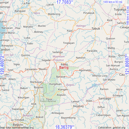
Barlig GPS coordinates[2]
17° 2' 14.1" North, 121° 6' 13.824" East
| Map corner | latitude | longitude |
|---|---|---|
| Upper-left | 17.7083°, | 120.40072° |
| Center: | 17.03725°, | 121.10384° |
| Lower-right: | 16.36379°, | 121.80697° |
| Map W x H: | 149.5×149.5 km | = 92.9×92.9mi |
| max Lat: | 20.78733° ⇑6.2% North |
| Barlig: | 17.03725° |
| min Lat: | ⇓93.8% South 4.65442° |
| min Long | Barlig | max Long |
| 117.04868° | 121.10384° | 126.58417° |
| W 26.3%⇐ | ⇒73.7% E |
Elevation
Elevation of Barlig is 1474 m = 4836 ft, and this is 1386.1 m = 4548 ft above average elevation for this country.
| Max E: |
2262 m = 7421 ft | 0.2% |
| Barlig | 1474 m 4836 ft | |
| Avg. | 87.9 m = 288 ft | |
Min E: |
-2 m = -7 ft | 99.8% |
See also: Philippines elevation on elevation.city.
Geographical zone
Barlig is located in North Torrid zone (between Equator and Tropic of Cancer). Distance of this Northern Tropic circle is 711.6 km =442.2 mi to North.| Distance of | km | miles | from Barlig |
|---|---|---|---|
| North Pole | 8112.7 | 5041 | to North |
| Arctic Circle | 5506.8 | 3421.8 | to North |
| Tropic Cancer | 711.6 | 442.2 | to North |
| Equator | 1894.4 | 1177.1 | to South |


Nearby cities:
15 places around Barlig: (largest is in red/bold)
• Banaue
14.5 km =9 mi,  197°
197°
• Bauko
25.7 km =16 mi,  258°
258°
• Besao
26.9 km =16.7 mi,  283°
283°
• Betwagan
15.5 km =9.6 mi,  289°
289°
• Bocos
13.3 km =8.3 mi, 201°
• Bontoc
14.6 km =9.1 mi, 292°
• Guinsadan
26.4 km =16.4 mi,  252°
252°
• Hapao
19.9 km =12.4 mi,  208°
208°
• Lagawe
26.4 km =16.4 mi,  176°
176°
• Natonin
20 km =12.4 mi,  66°
66°
• Sabangan
19.6 km =12.2 mi, 258°
• Sadanga
16.9 km =10.5 mi,  327°
327°
• Sadsadan
27.7 km =17.2 mi, 245°
• Sagada
22.3 km =13.9 mi, 283°
• Tinglayan
27.3 km =17 mi,  13°
13°
Sources, notices
• [Note1] Compared only with cities in Philippines existing in our database
• [Src1] Map data: © OpenStreetMap contributors (CC-BY-SA)
• [Src2] Other city data from geonames.org with taken over terms of usage.
• [Src3] Geographical zone / Annual Mean Temperature by Robert A. Rohde @ Wikipedia
