Baka geodata
Baka (Autonomous Region in Muslim Mindanao) is a populated place; located in Philippines in Asia/Manila (GMT+8) time zone. With population of 2,404 people, there are 3452 cities with bigger population in this country. Compared to other cities in Philippines, 88.8% of cities are located further ↑North; 74.8% of cities are located further ←West and 54.5% of cities have higher elevation than Baka. Note1
Administrative division(s):
- Level 1: Autonomous Region in Muslim Mindanao
- Level 2: Province of Maguindanao
- Level 3: Sultan Mastura


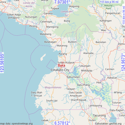
Baka GPS coordinates[2]
7° 16' 33.996" North, 124° 15' 51.012" East
| Map corner | latitude | longitude |
|---|---|---|
| Upper-left | 7.97301°, | 123.56105° |
| Center: | 7.27611°, | 124.26417° |
| Lower-right: | 6.57812°, | 124.9673° |
| Map W x H: | 155.1×155.1 km | = 96.4×96.4mi |
| max Lat: | 20.78733° ⇑88.8% North |
| Baka: | 7.27611° |
| min Lat: | ⇓11.2% South 4.65442° |
| min Long | Baka | max Long |
| 117.04868° | 124.26417° | 126.58417° |
| W 74.8%⇐ | ⇒25.2% E |
Elevation
Elevation of Baka is 20 m = 66 ft, and this is 67.9 m = 223 ft below average elevation for this country.
| Max E: |
2262 m = 7421 ft | 54.5% |
| Avg. | 87.9 m = 288 ft | |
| Baka | 20 m = 66 ft | |
Min E: |
-2 m = -7 ft | 45.5% |
See also: Philippines elevation on elevation.city.
Geographical zone
Baka is located in North Torrid zone (between Equator and Tropic of Cancer). Distance of Equator is 809 km =502.7 mi to South.| Distance of | km | miles | from Baka |
|---|---|---|---|
| North Pole | 9198 | 5715.4 | to North |
| Arctic Circle | 6592.1 | 4096.1 | to North |
| Tropic Cancer | 1796.9 | 1116.5 | to North |
| Equator | 809 | 502.7 | to South |


Nearby cities:
15 places around Baka: (largest is in red/bold)
• Awang
14.5 km =9 mi,  199°
199°
• Cotabato
6.2 km =3.9 mi, 198°
• Dalumangcob
7.7 km =4.8 mi,  149°
149°
• Dinganen
13.9 km =8.6 mi,  65°
65°
• Gang
3.4 km =2.1 mi,  175°
175°
• Katidtuan
11.2 km =7 mi, 149°
• Limbo
3.5 km =2.2 mi,  219°
219°
• Parang
10.5 km =6.5 mi,  3°
3°
• Pinaring
7.3 km =4.5 mi,  135°
135°
• Polloc
9.8 km =6.1 mi,  330°
330°
• Salimbao
6.1 km =3.8 mi,  191°
191°
• Simuay
4.7 km =2.9 mi,  88°
88°
• Sultan Kudarat
5.3 km =3.3 mi, 187°
• Tamontaka
11.4 km =7.1 mi, 201°
• Tapayan
2 km =1.2 mi,  5°
5°
Sources, notices
• [Note1] Compared only with cities in Philippines existing in our database
• [Src1] Map data: © OpenStreetMap contributors (CC-BY-SA)
• [Src2] Other city data from geonames.org with taken over terms of usage.
• [Src3] Geographical zone / Annual Mean Temperature by Robert A. Rohde @ Wikipedia
