Albuera geodata
Albuera (Eastern Visayas) is a seat of a third-order administrative division; located in Philippines in Asia/Manila (GMT+8) time zone. With population of 4,968 people, there are 1310 cities with bigger population in this country. Compared to other cities in Philippines, 57.8% of cities are located further ↑North; 82.2% of cities are located further ←West and 89.7% of cities have higher elevation than Albuera. Note1


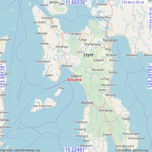
Albuera GPS coordinates[2]
10° 54' 56.88" North, 124° 41' 40.2" East
| Map corner | latitude | longitude |
|---|---|---|
| Upper-left | 11.60538°, | 123.99138° |
| Center: | 10.9158°, | 124.6945° |
| Lower-right: | 10.22461°, | 125.39763° |
| Map W x H: | 153.5×153.5 km | = 95.4×95.4mi |
| max Lat: | 20.78733° ⇑57.8% North |
| Albuera: | 10.9158° |
| min Lat: | ⇓42.2% South 4.65442° |
| min Long | Albuera | max Long |
| 117.04868° | 124.6945° | 126.58417° |
| W 82.2%⇐ | ⇒17.8% E |
Elevation
Elevation of Albuera is 7 m = 23 ft, and this is 80.9 m = 265 ft below average elevation for this country.
| Max E: |
2262 m = 7421 ft | 89.7% |
| Avg. | 87.9 m = 288 ft | |
| Albuera | 7 m = 23 ft | |
Min E: |
-2 m = -7 ft | 10.3% |
See also: Philippines elevation on elevation.city.
Geographical zone
Albuera is located in North Torrid zone (between Equator and Tropic of Cancer). Distance of Equator is 1213.7 km =754.2 mi to South.| Distance of | km | miles | from Albuera |
|---|---|---|---|
| North Pole | 8793.3 | 5463.9 | to North |
| Arctic Circle | 6187.5 | 3844.7 | to North |
| Tropic Cancer | 1392.2 | 865.1 | to North |
| Equator | 1213.7 | 754.2 | to South |


Nearby cities:
15 places around Albuera: (largest is in red/bold)
• Balogo
3.7 km =2.3 mi,  151°
151°
• Bunga
18.7 km =11.6 mi, 148°
• Caridad
11.3 km =7 mi, 146°
• Dolores
18.5 km =11.5 mi,  331°
331°
• Ipil
9.1 km =5.7 mi,  315°
315°
• Lao
18.6 km =11.6 mi,  307°
307°
• Libas
16.5 km =10.3 mi,  278°
278°
• Merida
17.1 km =10.6 mi,  267°
267°
• Ormoc
13.8 km =8.6 mi, 316°
• Pilar
18.6 km =11.6 mi,  229°
229°
• Puerto Bello
18.5 km =11.5 mi,  290°
290°
• San Pedro
14.6 km =9.1 mi,  69°
69°
• Siguinon
3.3 km =2.1 mi, 332°
• Talisayan
3.8 km =2.4 mi,  8°
8°
• Tugbong
15.2 km =9.4 mi, 317°
Sources, notices
• [Note1] Compared only with cities in Philippines existing in our database
• [Src1] Map data: © OpenStreetMap contributors (CC-BY-SA)
• [Src2] Other city data from geonames.org with taken over terms of usage.
• [Src3] Geographical zone / Annual Mean Temperature by Robert A. Rohde @ Wikipedia
