Camudmud geodata
Camudmud (Davao) is a populated place; located in Philippines in Asia/Manila (GMT+8) time zone. With population of 2,189 people, there are 3909 cities with bigger population in this country. Compared to other cities in Philippines, 89.7% of cities are located further ↑North; 95.6% of cities are located further ←West and 95.5% of cities have higher elevation than Camudmud. Note1
Administrative division(s):
- Level 1: Davao
- Level 2: Province of Davao del Norte
- Level 3: Island Garden City of Samal


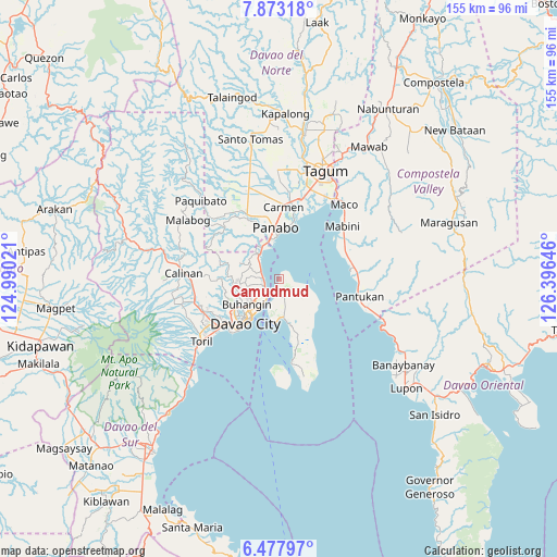
Camudmud GPS coordinates[2]
7° 10' 33.996" North, 125° 41' 35.988" East
| Map corner | latitude | longitude |
|---|---|---|
| Upper-left | 7.87318°, | 124.99021° |
| Center: | 7.17611°, | 125.69333° |
| Lower-right: | 6.47797°, | 126.39646° |
| Map W x H: | 155.1×155.1 km | = 96.4×96.4mi |
| max Lat: | 20.78733° ⇑89.7% North |
| Camudmud: | 7.17611° |
| min Lat: | ⇓10.3% South 4.65442° |
| min Long | Camudmud | max Long |
| 117.04868° | 125.69333° | 126.58417° |
| W 95.6%⇐ | ⇒4.4% E |
Elevation
Elevation of Camudmud is 5 m = 16 ft, and this is 82.9 m = 272 ft below average elevation for this country.
| Max E: |
2262 m = 7421 ft | 95.5% |
| Avg. | 87.9 m = 288 ft | |
| Camudmud | 5 m = 16 ft | |
Min E: |
-2 m = -7 ft | 4.5% |
See also: Philippines elevation on elevation.city.
Geographical zone
Camudmud is located in North Torrid zone (between Equator and Tropic of Cancer). Distance of Equator is 797.9 km =495.8 mi to South.| Distance of | km | miles | from Camudmud |
|---|---|---|---|
| North Pole | 9209.2 | 5722.3 | to North |
| Arctic Circle | 6603.3 | 4103.1 | to North |
| Tropic Cancer | 1808 | 1123.4 | to North |
| Equator | 797.9 | 495.8 | to South |


Nearby cities:
15 places around Camudmud: (largest is in red/bold)
• Aumbay
12.9 km =8 mi,  129°
129°
• Babak
4.5 km =2.8 mi,  188°
188°
• Cogon
3.9 km =2.4 mi,  136°
136°
• Davao
14.5 km =9 mi,  217°
217°
• La Paz
16.1 km =10 mi,  15°
15°
• Lasang
10.6 km =6.6 mi,  342°
342°
• Limao
11 km =6.8 mi, 191°
• Maduao
15.1 km =9.4 mi,  330°
330°
• Mahayag
9.3 km =5.8 mi,  298°
298°
• Mambago
7.8 km =4.8 mi,  179°
179°
• Panabo
14.7 km =9.1 mi,  356°
356°
• Samal
11.4 km =7.1 mi,  171°
171°
• San Antonio
8.1 km =5 mi, 140°
• Santo Niño
16.9 km =10.5 mi,  4°
4°
• Tambo
2.2 km =1.4 mi,  163°
163°
Sources, notices
• [Note1] Compared only with cities in Philippines existing in our database
• [Src1] Map data: © OpenStreetMap contributors (CC-BY-SA)
• [Src2] Other city data from geonames.org with taken over terms of usage.
• [Src3] Geographical zone / Annual Mean Temperature by Robert A. Rohde @ Wikipedia
