Maduao geodata
Maduao (Davao) is a populated place; located in Philippines in Asia/Manila (GMT+8) time zone. With population of 2,143 people, there are 4003 cities with bigger population in this country. Compared to other cities in Philippines, 88.6% of cities are located further ↑North; 94.9% of cities are located further ←West and 53.5% of cities have lower elevation than Maduao. Note1
Administrative division(s):
- Level 1: Davao
- Level 2: Province of Davao del Norte
- Level 3: City of Panabo


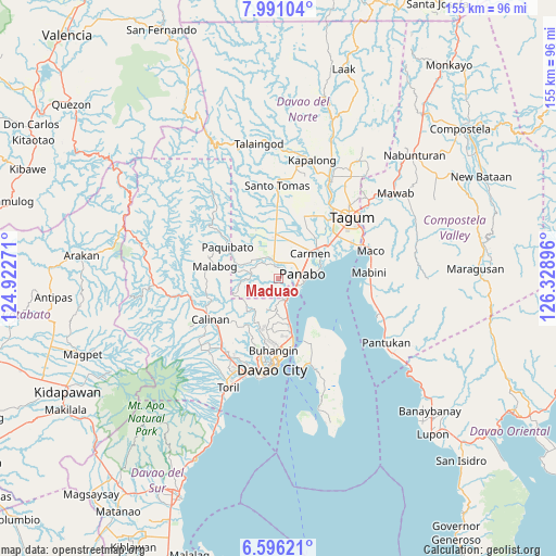
Maduao GPS coordinates[2]
7° 17' 39.012" North, 125° 37' 32.988" East
| Map corner | latitude | longitude |
|---|---|---|
| Upper-left | 7.99104°, | 124.92271° |
| Center: | 7.29417°, | 125.62583° |
| Lower-right: | 6.59621°, | 126.32896° |
| Map W x H: | 155.1×155.1 km | = 96.4×96.4mi |
| max Lat: | 20.78733° ⇑88.6% North |
| Maduao: | 7.29417° |
| min Lat: | ⇓11.4% South 4.65442° |
| min Long | Maduao | max Long |
| 117.04868° | 125.62583° | 126.58417° |
| W 94.9%⇐ | ⇒5.1% E |
Elevation
Elevation of Maduao is 26 m = 85 ft, and this is 61.9 m = 203 ft below average elevation for this country.
| Max E: |
2262 m = 7421 ft | 46.5% |
| Avg. | 87.9 m = 288 ft | |
| Maduao | 26 m = 85 ft | |
Min E: |
-2 m = -7 ft | 53.5% |
See also: Philippines elevation on elevation.city.
Geographical zone
Maduao is located in North Torrid zone (between Equator and Tropic of Cancer). Distance of Equator is 811 km =503.9 mi to South.| Distance of | km | miles | from Maduao |
|---|---|---|---|
| North Pole | 9196 | 5714.1 | to North |
| Arctic Circle | 6590.1 | 4094.9 | to North |
| Tropic Cancer | 1794.9 | 1115.3 | to North |
| Equator | 811 | 503.9 | to South |


Nearby cities:
15 places around Maduao: (largest is in red/bold)
• Alejal
10.7 km =6.6 mi,  20°
20°
• Carmen
11.6 km =7.2 mi,  50°
50°
• Katipunan
3 km =1.9 mi,  348°
348°
• La Paz
12.1 km =7.5 mi,  78°
78°
• Lasang
5.3 km =3.3 mi,  125°
125°
• Mabuhay
9.7 km =6 mi,  296°
296°
• Magsaysay
11.4 km =7.1 mi,  5°
5°
• Mahayag
8.6 km =5.3 mi,  184°
184°
• Manaloal
8.9 km =5.5 mi,  25°
25°
• Manay
7.7 km =4.8 mi,  313°
313°
• Nanyo
4.5 km =2.8 mi, 16°
• Panabo
6.6 km =4.1 mi, 76°
• Santo Niño
9.5 km =5.9 mi,  66°
66°
• Tubod
8.9 km =5.5 mi, 13°
• Tuganay
13.6 km =8.5 mi, 52°
Sources, notices
• [Note1] Compared only with cities in Philippines existing in our database
• [Src1] Map data: © OpenStreetMap contributors (CC-BY-SA)
• [Src2] Other city data from geonames.org with taken over terms of usage.
• [Src3] Geographical zone / Annual Mean Temperature by Robert A. Rohde @ Wikipedia
