Santo Niño geodata
Santo Niño (Davao) is a populated place; located in Philippines in Asia/Manila (GMT+8) time zone. With population of 3,787 people, there are 1853 cities with bigger population in this country. Compared to other cities in Philippines, 88.3% of cities are located further ↑North; 95.8% of cities are located further ←West and 73.2% of cities have higher elevation than Santo Niño. Note1


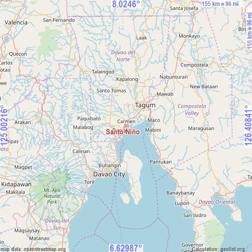
Santo Niño GPS coordinates[2]
7° 19' 40.008" North, 125° 42' 19.008" East
| Map corner | latitude | longitude |
|---|---|---|
| Upper-left | 8.0246°, | 125.00216° |
| Center: | 7.32778°, | 125.70528° |
| Lower-right: | 6.62987°, | 126.40841° |
| Map W x H: | 155.1×155.1 km | = 96.4×96.4mi |
| max Lat: | 20.78733° ⇑88.3% North |
| Santo Niño: | 7.32778° |
| min Lat: | ⇓11.7% South 4.65442° |
| min Long | Santo Niño | max Long |
| 117.04868° | 125.70528° | 126.58417° |
| W 95.8%⇐ | ⇒4.2% E |
Elevation
Elevation of Santo Niño is 11 m = 36 ft, and this is 76.9 m = 252 ft below average elevation for this country.
| Max E: |
2262 m = 7421 ft | 73.2% |
| Avg. | 87.9 m = 288 ft | |
| Santo Niño | 11 m = 36 ft | |
Min E: |
-2 m = -7 ft | 26.8% |
See also: Philippines elevation on elevation.city.
Geographical zone
Santo Niño is located in North Torrid zone (between Equator and Tropic of Cancer). Distance of Equator is 814.8 km =506.3 mi to South.| Distance of | km | miles | from Santo Niño |
|---|---|---|---|
| North Pole | 9192.3 | 5711.8 | to North |
| Arctic Circle | 6586.4 | 4092.6 | to North |
| Tropic Cancer | 1791.1 | 1112.9 | to North |
| Equator | 814.8 | 506.3 | to South |


Nearby cities:
15 places around Santo Niño: (largest is in red/bold)
• Alejal
8 km =5 mi,  321°
321°
• Anibongan
7.4 km =4.6 mi,  11°
11°
• Bincoñgan
6.6 km =4.1 mi,  48°
48°
• Cabayangan
9.3 km =5.8 mi,  19°
19°
• Carmen
3.6 km =2.2 mi,  1°
1°
• Katipunan
9.4 km =5.8 mi,  264°
264°
• La Paz
3.4 km =2.1 mi,  113°
113°
• Lasang
8.1 km =5 mi,  213°
213°
• Libuganon
8.4 km =5.2 mi,  73°
73°
• Maduao
9.5 km =5.9 mi,  246°
246°
• Manaloal
6.5 km =4 mi,  310°
310°
• Nanyo
7.5 km =4.7 mi,  274°
274°
• Panabo
3.2 km =2 mi,  226°
226°
• Tubod
8.3 km =5.2 mi, 306°
• Tuganay
5 km =3.1 mi, 23°
Sources, notices
• [Note1] Compared only with cities in Philippines existing in our database
• [Src1] Map data: © OpenStreetMap contributors (CC-BY-SA)
• [Src2] Other city data from geonames.org with taken over terms of usage.
• [Src3] Geographical zone / Annual Mean Temperature by Robert A. Rohde @ Wikipedia
