Barangay of Poblacion geodata
Barangay of Poblacion (Mimaropa) is a seat of a fourth-order administrative division; located in Philippines in Asia/Manila (GMT+8) time zone. In our database, there are 4166 cities with bigger population. Compared to other cities in Philippines, 60.3% of cities are located further ↓South; 59.3% of cities are located further →East and 67.1% of cities have lower elevation than Barangay of Poblacion. Note1


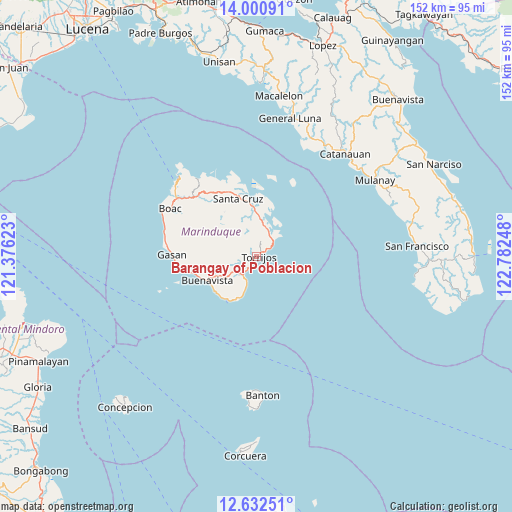
Barangay of Poblacion GPS coordinates[2]
13° 19' 3.648" North, 122° 4' 45.66" East
| Map corner | latitude | longitude |
|---|---|---|
| Upper-left | 14.00091°, | 121.37623° |
| Center: | 13.31768°, | 122.07935° |
| Lower-right: | 12.63251°, | 122.78248° |
| Map W x H: | 152.2×152.2 km | = 94.6×94.6mi |
| max Lat: | 20.78733° ⇑39.7% North |
| Barangay of Poblacion: | 13.31768° |
| min Lat: | ⇓60.3% South 4.65442° |
| min Long | Barangay of Pob | max Long |
| 117.04868° | 122.07935° | 126.58417° |
| W 40.7%⇐ | ⇒59.3% E |
Elevation
Elevation of Barangay of Poblacion is 46 m = 151 ft, and this is 41.9 m = 137 ft below average elevation for this country.
| Max E: |
2262 m = 7421 ft | 32.9% |
| Avg. | 87.9 m = 288 ft | |
| Barangay of Poblacion | 46 m = 151 ft | |
Min E: |
-2 m = -7 ft | 67.1% |
See also: Philippines elevation on elevation.city.
Geographical zone
Barangay of Poblacion is located in North Torrid zone (between Equator and Tropic of Cancer). Distance of this Northern Tropic circle is 1125.1 km =699.1 mi to North.| Distance of | km | miles | from Barangay of Poblacion |
|---|---|---|---|
| North Pole | 8526.3 | 5298 | to North |
| Arctic Circle | 5920.4 | 3678.8 | to North |
| Tropic Cancer | 1125.1 | 699.1 | to North |
| Equator | 1480.8 | 920.1 | to South |


Nearby cities:
15 places around Barangay of Poblacion: (largest is in red/bold)
• Buenavista
16.5 km =10.3 mi,  244°
244°
• Buyabod
16.8 km =10.4 mi,  350°
350°
• Caigangan
17.1 km =10.6 mi,  247°
247°
• Daykitin
19 km =11.8 mi, 254°
• Gasan
25.2 km =15.7 mi,  271°
271°
• Ipil
24.1 km =15 mi,  334°
334°
• Libas
15.8 km =9.8 mi, 237°
• Malibago
7.5 km =4.7 mi,  234°
234°
• Masiga
27.6 km =17.1 mi,  279°
279°
• Mogpog
29.3 km =18.2 mi,  306°
306°
• Santa Cruz
18.5 km =11.5 mi,  342°
342°
• Tigui
6.9 km =4.3 mi,  216°
216°
• Tiguion
23.7 km =14.7 mi, 274°
• Torrijos
0.3 km =0.2 mi,  109°
109°
• Yook
16.1 km =10 mi, 230°
Sources, notices
• [Note1] Compared only with cities in Philippines existing in our database
• [Src1] Map data: © OpenStreetMap contributors (CC-BY-SA)
• [Src2] Other city data from geonames.org with taken over terms of usage.
• [Src3] Geographical zone / Annual Mean Temperature by Robert A. Rohde @ Wikipedia
