Liliani geodata
Liliani (Punjab) is a populated place; located in Pakistan in Asia/Karachi (GMT+5) time zone. With population of 12,211 people, there are 337 cities with bigger population in this country. Compared to other cities in Pakistan, 69.1% of cities are located further ↓South; 71.1% of cities are located further ←West and 56.2% of cities have lower elevation than Liliani. Note1


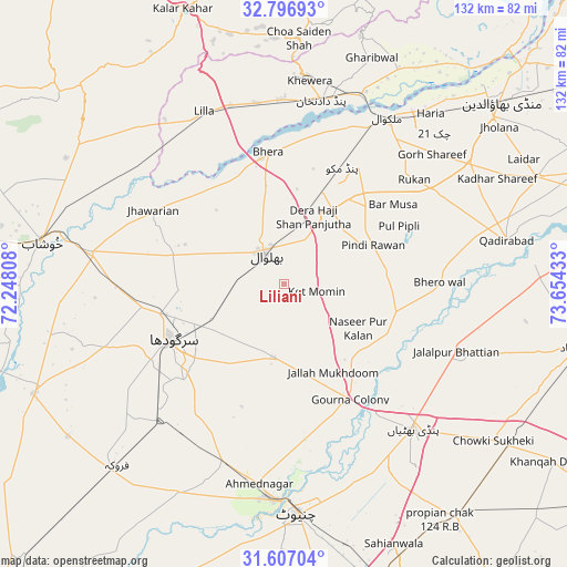
Liliani GPS coordinates[2]
32° 12' 14.148" North, 72° 57' 4.32" East
| Map corner | latitude | longitude |
|---|---|---|
| Upper-left | 32.79693°, | 72.24808° |
| Center: | 32.20393°, | 72.9512° |
| Lower-right: | 31.60704°, | 73.65433° |
| Map W x H: | 132.3×132.3 km | = 82.2×82.2mi |
| max Lat: | 36.32162° ⇑30.9% North |
| Liliani: | 32.20393° |
| min Lat: | ⇓69.1% South 24.14422° |
| min Long | Liliani | max Long |
| 61.74573° | 72.9512° | 75.63372° |
| W 71.1%⇐ | ⇒28.9% E |
Elevation
Elevation of Liliani is 194 m = 636 ft, and this is 151 m = 495 ft below average elevation for this country.
| Max E: |
2732 m = 8963 ft | 43.8% |
| Avg. | 345 m = 1132 ft | |
| Liliani | 194 m = 636 ft | |
Min E: |
3 m = 10 ft | 56.2% |
See also: Pakistan elevation on elevation.city.
Geographical zone
Liliani is located in North temperate zone (between Tropic of Cancer and the Arctic Circle). Distance of this Northern Tropic circle is 974.8 km =605.7 mi to South.| Distance of | km | miles | from Liliani |
|---|---|---|---|
| North Pole | 6426.3 | 3993.1 | to North |
| Arctic Circle | 3820.4 | 2373.9 | to North |
| Tropic Cancer | 974.8 | 605.7 | to South |
| Equator | 3580.7 | 2224.9 | to South |


Nearby cities:
15 places around Liliani: (largest is in red/bold)
• Bhalwal
8.5 km =5.3 mi,  323°
323°
• Bhera
31.2 km =19.4 mi,  352°
352°
• Chenab Nagar
50 km =31.1 mi,  184°
184°
• Dandot RS
48.7 km =30.3 mi,  2°
2°
• Jhawarian
35.5 km =22.1 mi,  299°
299°
• Keshupur
42.9 km =26.7 mi,  278°
278°
• Khewra
49.8 km =30.9 mi,  6°
6°
• Kot Mumin
7.6 km =4.7 mi,  103°
103°
• Lalian
44.5 km =27.7 mi,  198°
198°
• Malakwal
46.1 km =28.6 mi,  32°
32°
• Malakwal City
46.1 km =28.6 mi, 32°
• Pind Dadan Khan
43.4 km =27 mi, 11°
• Pindi Bhattian
45.6 km =28.3 mi,  138°
138°
• Sargodha
29.2 km =18.1 mi,  243°
243°
• Shahpur
45.9 km =28.5 mi, 278°
Sources, notices
• [Note1] Compared only with cities in Pakistan existing in our database
• [Src1] Map data: © OpenStreetMap contributors (CC-BY-SA)
• [Src2] Other city data from geonames.org with taken over terms of usage.
• [Src3] Geographical zone / Annual Mean Temperature by Robert A. Rohde @ Wikipedia
