Zebrzydowice geodata
Zebrzydowice (Silesia) is a populated place; located in Poland in Europe/Warsaw (GMT+2) time zone. With population of 5,046 people, there are 684 cities with bigger population in this country. Compared to other cities in Poland, 88.6% of cities are located further ↑North; 66.4% of cities are located further →East and 69.1% of cities have lower elevation than Zebrzydowice. Note1


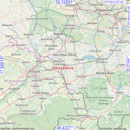
Zebrzydowice GPS coordinates[2]
49° 52' 40.548" North, 18° 36' 40.572" East
| Map corner | latitude | longitude |
|---|---|---|
| Upper-left | 50.32891°, | 17.90815° |
| Center: | 49.87793°, | 18.61127° |
| Lower-right: | 49.4227°, | 19.3144° |
| Map W x H: | 100.8×100.8 km | = 62.6×62.6mi |
| max Lat: | 54.83135° ⇑88.6% North |
| Zebrzydowice: | 49.87793° |
| min Lat: | ⇓11.4% South 49.21328° |
| min Long | Zebrzydowice | max Long |
| 14.20249° | 18.61127° | 24.03723° |
| W 33.6%⇐ | ⇒66.4% E |
Elevation
Elevation of Zebrzydowice is 226 m = 741 ft, and this is 34.6 m = 114 ft above average elevation for this country.
| Max E: |
974 m = 3196 ft | 30.9% |
| Zebrzydowice | 226 m 741 ft | |
| Avg. | 191.4 m = 628 ft | |
Min E: |
-3 m = -10 ft | 69.1% |
See also: Poland elevation on elevation.city.
Geographical zone
Zebrzydowice is located in North temperate zone (between Tropic of Cancer and the Arctic Circle). Distance of this North polar circle is 1855.3 km =1152.8 mi to North.| Distance of | km | miles | from Zebrzydowice |
|---|---|---|---|
| North Pole | 4461.2 | 2772.1 | to North |
| Arctic Circle | 1855.3 | 1152.8 | to North |
| Tropic Cancer | 2940 | 1826.8 | to South |
| Equator | 5545.9 | 3446.1 | to South |


Nearby cities:
15 places around Zebrzydowice: (largest is in red/bold)
• Bąków
7.6 km =4.7 mi,  76°
76°
• Drogomyśl
10.5 km =6.5 mi,  95°
95°
• Dębowiec
10.6 km =6.6 mi,  132°
132°
• Godów
10.9 km =6.8 mi,  298°
298°
• Gołkowice
8 km =5 mi, 300°
• Hażlach
8.4 km =5.2 mi,  159°
159°
• Jastrzębie Zdrój
9 km =5.6 mi,  343°
343°
• Kaczyce
5.8 km =3.6 mi,  194°
194°
• Kostkowice
11.3 km =7 mi,  145°
145°
• Kończyce Małe
2.6 km =1.6 mi, 148°
• Kończyce Wielkie
5.3 km =3.3 mi, 153°
• Pielgrzymowice
4.1 km =2.5 mi,  41°
41°
• Pogwizdów
8.3 km =5.2 mi, 185°
• Pruchna
5.3 km =3.3 mi,  105°
105°
• Zbytków
9.7 km =6 mi,  58°
58°
Sources, notices
• [Note1] Compared only with cities in Poland existing in our database
• [Src1] Map data: © OpenStreetMap contributors (CC-BY-SA)
• [Src2] Other city data from geonames.org with taken over terms of usage.
• [Src3] Geographical zone / Annual Mean Temperature by Robert A. Rohde @ Wikipedia
