Uraz geodata
Uraz (Lower Silesia) is a populated place; located in Poland in Europe/Warsaw (GMT+2) time zone. With population of 886 people, there are 2702 cities with bigger population in this country. Compared to other cities in Poland, 52.1% of cities are located further ↓South; 86.7% of cities are located further →East and 75.8% of cities have higher elevation than Uraz. Note1
Administrative division(s):
- Level 1: Lower Silesia
- Level 2: Powiat trzebnicki
- Level 3: Oborniki Śląskie


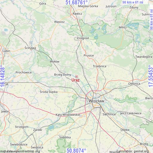
Uraz GPS coordinates[2]
51° 14' 58.596" North, 16° 51' 5.04" East
| Map corner | latitude | longitude |
|---|---|---|
| Upper-left | 51.68761°, | 16.14828° |
| Center: | 51.24961°, | 16.8514° |
| Lower-right: | 50.8074°, | 17.55453° |
| Map W x H: | 97.9×97.9 km | = 60.8×60.8mi |
| max Lat: | 54.83135° ⇑47.9% North |
| Uraz: | 51.24961° |
| min Lat: | ⇓52.1% South 49.21328° |
| min Long | Uraz | max Long |
| 14.20249° | 16.8514° | 24.03723° |
| W 13.3%⇐ | ⇒86.7% E |
Elevation
Elevation of Uraz is 109 m = 358 ft, and this is 82.4 m = 270 ft below average elevation for this country.
| Max E: |
974 m = 3196 ft | 75.8% |
| Avg. | 191.4 m = 628 ft | |
| Uraz | 109 m = 358 ft | |
Min E: |
-3 m = -10 ft | 24.2% |
See also: Poland elevation on elevation.city.
Geographical zone
Uraz is located in North temperate zone (between Tropic of Cancer and the Arctic Circle). Distance of this North polar circle is 1702.8 km =1058.1 mi to North.| Distance of | km | miles | from Uraz |
|---|---|---|---|
| North Pole | 4308.6 | 2677.2 | to North |
| Arctic Circle | 1702.8 | 1058.1 | to North |
| Tropic Cancer | 3092.5 | 1921.6 | to South |
| Equator | 5698.4 | 3540.8 | to South |


Nearby cities:
15 places around Uraz: (largest is in red/bold)
• Brzeg Dolny
10.3 km =6.4 mi,  284°
284°
• Kozanów
14.3 km =8.9 mi,  144°
144°
• Leśnica-Ratyń-Pustki
11.9 km =7.4 mi,  181°
181°
• Lutynia
13.5 km =8.4 mi,  200°
200°
• Marszowice
8.9 km =5.5 mi,  165°
165°
• Maślice Małe
12.8 km =8 mi,  150°
150°
• Maślice Wielkie
11 km =6.8 mi, 150°
• Miękinia
10.5 km =6.5 mi,  229°
229°
• Mrozów
8.1 km =5 mi,  212°
212°
• Nowe Żerniki-Kolonie Żernickie
13.7 km =8.5 mi,  158°
158°
• Oborniki Śląskie
7.2 km =4.5 mi,  37°
37°
• Pracze Odrzańskie-Janówek
7.9 km =4.9 mi, 150°
• Stabłowice
11.2 km =7 mi, 162°
• Wisznia Mała
13.5 km =8.4 mi,  90°
90°
• Złotniki
12.7 km =7.9 mi, 168°
Sources, notices
• [Note1] Compared only with cities in Poland existing in our database
• [Src1] Map data: © OpenStreetMap contributors (CC-BY-SA)
• [Src2] Other city data from geonames.org with taken over terms of usage.
• [Src3] Geographical zone / Annual Mean Temperature by Robert A. Rohde @ Wikipedia
