Miękinia geodata
Miękinia (Lower Silesia) is a seat of a third-order administrative division; located in Poland in Europe/Warsaw (GMT+2) time zone. With population of 2,500 people, there are 1240 cities with bigger population in this country. Compared to other cities in Poland, 50.6% of cities are located further ↓South; 87.8% of cities are located further →East and 70.4% of cities have higher elevation than Miękinia. Note1


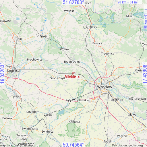
Miękinia GPS coordinates[2]
51° 11' 18.384" North, 16° 44' 9.42" East
| Map corner | latitude | longitude |
|---|---|---|
| Upper-left | 51.62703°, | 16.03283° |
| Center: | 51.18844°, | 16.73595° |
| Lower-right: | 50.74564°, | 17.43908° |
| Map W x H: | 98×98 km | = 60.9×60.9mi |
| max Lat: | 54.83135° ⇑49.4% North |
| Miękinia: | 51.18844° |
| min Lat: | ⇓50.6% South 49.21328° |
| min Long | Miękinia | max Long |
| 14.20249° | 16.73595° | 24.03723° |
| W 12.2%⇐ | ⇒87.8% E |
Elevation
Elevation of Miękinia is 120 m = 394 ft, and this is 71.4 m = 234 ft below average elevation for this country.
| Max E: |
974 m = 3196 ft | 70.4% |
| Avg. | 191.4 m = 628 ft | |
| Miękinia | 120 m = 394 ft | |
Min E: |
-3 m = -10 ft | 29.6% |
See also: Poland elevation on elevation.city.
Geographical zone
Miękinia is located in North temperate zone (between Tropic of Cancer and the Arctic Circle). Distance of this North polar circle is 1709.6 km =1062.3 mi to North.| Distance of | km | miles | from Miękinia |
|---|---|---|---|
| North Pole | 4315.4 | 2681.5 | to North |
| Arctic Circle | 1709.6 | 1062.3 | to North |
| Tropic Cancer | 3085.7 | 1917.4 | to South |
| Equator | 5691.6 | 3536.6 | to South |


Nearby cities:
15 places around Miękinia: (largest is in red/bold)
• Brzeg Dolny
9.6 km =6 mi,  348°
348°
• Ciechów
13.3 km =8.3 mi,  241°
241°
• Jarnołtów-Jerzmanowo
11.7 km =7.3 mi,  129°
129°
• Leśnica-Ratyń-Pustki
9.3 km =5.8 mi,  123°
123°
• Lutynia
6.8 km =4.2 mi,  150°
150°
• Marszowice
10.5 km =6.5 mi,  100°
100°
• Małkowice
13.8 km =8.6 mi, 153°
• Maślice Wielkie
13.7 km =8.5 mi, 101°
• Mrozów
3.6 km =2.2 mi,  90°
90°
• Pracze Odrzańskie-Janówek
12 km =7.5 mi, 90°
• Stabłowice
12.1 km =7.5 mi,  108°
108°
• Szczepanów
8.8 km =5.5 mi,  276°
276°
• Uraz
10.5 km =6.5 mi,  49°
49°
• Złotniki
12.1 km =7.5 mi, 117°
• Środa Śląska
10.2 km =6.3 mi,  254°
254°
Sources, notices
• [Note1] Compared only with cities in Poland existing in our database
• [Src1] Map data: © OpenStreetMap contributors (CC-BY-SA)
• [Src2] Other city data from geonames.org with taken over terms of usage.
• [Src3] Geographical zone / Annual Mean Temperature by Robert A. Rohde @ Wikipedia
