Brzeg Dolny geodata
Brzeg Dolny (Lower Silesia) is a populated place; located in Poland in Europe/Warsaw (GMT+2) time zone. With population of 12,689 people, there are 375 cities with bigger population in this country. Compared to other cities in Poland, 52.5% of cities are located further ↓South; 88% of cities are located further →East and 71.6% of cities have higher elevation than Brzeg Dolny. Note1


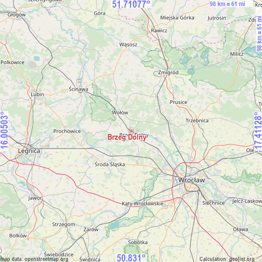
Brzeg Dolny GPS coordinates[2]
51° 16' 22.764" North, 16° 42' 29.34" East
| Map corner | latitude | longitude |
|---|---|---|
| Upper-left | 51.71077°, | 16.00503° |
| Center: | 51.27299°, | 16.70815° |
| Lower-right: | 50.831°, | 17.41128° |
| Map W x H: | 97.8×97.8 km | = 60.8×60.8mi |
| max Lat: | 54.83135° ⇑47.5% North |
| Brzeg Dolny: | 51.27299° |
| min Lat: | ⇓52.5% South 49.21328° |
| min Long | Brzeg Dolny | max Long |
| 14.20249° | 16.70815° | 24.03723° |
| W 12%⇐ | ⇒88% E |
Elevation
Elevation of Brzeg Dolny is 118 m = 387 ft, and this is 73.4 m = 241 ft below average elevation for this country.
| Max E: |
974 m = 3196 ft | 71.6% |
| Avg. | 191.4 m = 628 ft | |
| Brzeg Dolny | 118 m = 387 ft | |
Min E: |
-3 m = -10 ft | 28.4% |
See also: Poland elevation on elevation.city.
Geographical zone
Brzeg Dolny is located in North temperate zone (between Tropic of Cancer and the Arctic Circle). Distance of this North polar circle is 1700.2 km =1056.5 mi to North.| Distance of | km | miles | from Brzeg Dolny |
|---|---|---|---|
| North Pole | 4306 | 2675.6 | to North |
| Arctic Circle | 1700.2 | 1056.5 | to North |
| Tropic Cancer | 3095.1 | 1923.2 | to South |
| Equator | 5701 | 3542.4 | to South |


Nearby cities:
15 places around Brzeg Dolny: (largest is in red/bold)
• Ciechów
18.5 km =11.5 mi,  211°
211°
• Leśnica-Ratyń-Pustki
17.5 km =10.9 mi,  146°
146°
• Lutynia
16.2 km =10.1 mi,  160°
160°
• Malczyce
16 km =9.9 mi,  248°
248°
• Marszowice
16.6 km =10.3 mi,  132°
132°
• Maślice Wielkie
19.6 km =12.2 mi, 128°
• Miękinia
9.6 km =6 mi,  168°
168°
• Mrozów
11 km =6.8 mi, 149°
• Oborniki Śląskie
14.7 km =9.1 mi,  77°
77°
• Pracze Odrzańskie-Janówek
16.8 km =10.4 mi,  124°
124°
• Stabłowice
18.8 km =11.7 mi, 134°
• Szczepanów
10.8 km =6.7 mi,  219°
219°
• Uraz
10.3 km =6.4 mi,  104°
104°
• Wołów
8.3 km =5.2 mi,  327°
327°
• Środa Śląska
14.4 km =8.9 mi, 213°
Sources, notices
• [Note1] Compared only with cities in Poland existing in our database
• [Src1] Map data: © OpenStreetMap contributors (CC-BY-SA)
• [Src2] Other city data from geonames.org with taken over terms of usage.
• [Src3] Geographical zone / Annual Mean Temperature by Robert A. Rohde @ Wikipedia
